Richmond

Traversing Richmond Bridge
Richmond Bridge
Richmond Bridge © emily@traversingtasmania 2017

Richmond is a charming historic village in the south of Tasmania. It is particularly beautiful in autumn, when its many deciduous trees transform into living artworks. The locals love to wander its streets, picnic on the banks of the river and feed the ducks. Except, of course, when the ducks and a giant goose surround you and demand more bread than you want to give them! (Vegetable scraps are better for the ducks than bread if you’re planning to give them a treat).

Coal River
Coal River © emily@traversingtasmania 2017

Richmond has a rich history. You can walk across and underneath its 1823 convict-built bridge (do be careful as the bridge is used frequently by traffic). Its gaol, built from 1825 – 1840, is a very interesting place to visit (read about my experience here). I attended a wedding in St Lukes church, many years ago. It is recognisable by its distinct clock face. It seems that every café, gift shop and gallery is in a historic building. It’s a lovely atmosphere.

Richmond Bakery
Richmond Bakery © emily@traversingtasmania 2017

The appeal of Richmond lies in both its history and its food. The historic Richmond Bakery is a popular place to have a hearty breakfast or lunch. The Richmond Lolly Shop has been a local institution for as long as I can remember and is now a larger, modern version of its former self. Newer establishments are making their mark too, such as the scrumptious Czegs Café. When we visited, a special session of the local market was on for Mother’s Day, which was lovely! Usually, the market is open from 9am – 3pm on Saturdays only. There are many wineries to visit in the Coal River valley, in which the village is situated.

Richmond Lolly Shop
Richmond Lolly Shop © emily@traversingtasmania 2017

Some people visit Richmond just to shop. You’ll find wooden crafts, art galleries, gift shops and lots and lots of Tasmanian goodies. When you’re tired of shopping, you can visit the model village of Old Hobart Town or just sit on the grassed green or riverbank and soak in your surroundings. If you want to stay overnight in Richmond, you have the choice of several historic cottages.

Getting There

Richmond
Richmond © emily@traversingtasmania 2017

Richmond is approximately 25 minutes’ drive from Hobart CBD. From Hobart, drive towards Cambridge (follow signs for the airport). Once you’re in Cambridge, you’ll follow signs for Richmond. Keep driving for about 10 – 15 minutes and you’ll arrive in the village! If you can’t find parking in/near the village centre, cross the bridge and turn left. You should find a space there. Allow for extra travel time to Richmond as there are many excellent attractions to visit on the way. The village is in full swing seven days a week. The hours of individual businesses vary but major attractions, such as the Richmond Gaol, Bakery and Lolly Shop, are open seven days a week.

Cost

Richmond Bridge
Richmond Bridge © emily@traversingtasmania 2017

You can spend as little or as much as you like on a visit to Richmond. Attractions and purchases obviously attract fees but wandering along the riverbank, taking fabulous photos and using the picnic facilities (including gas barbecues) can all be done for free. There is no charge for parking which is also appealing! As a child, highlights were feeding the ducks, playing with my family by the riverbanks and walking under and over the bridge. As an adult, I enjoyed the scenery and the history (but I still walked under the bridge!). It is a beautiful place to visit!

Read more posts about Richmond here or read more about Tasmania’s south here.
Corinna

Traversing Corinna
Corinna
Corinna © emily@traversingtasmania 2017

Who wouldn’t want to stay the night in a ghost town? How about one on the edge of the takayna/Tarkine? What if you could then spend the day traversing ancient rivers, forests and mountains and the evening snuggled up next to a gas heater in a pioneer-style hut? Welcome to Corinna, an ex-mining town on the north bank of the Pieman River on Tasmania’s wild West Coast.

Tarkine Hotel
Tarkine Hotel © emily@traversingtasmania 2017

Corinna is the Tasmanian Aboriginal name for the Pieman River. The town was established during the gold rush of the late 1800s. Here, 2500 people lived and a 7.5kg gold nugget was discovered. This is still the largest gold nugget found in Tasmania. The town had a substantial two-storey pub, which was later dismantled and moved to the south side of the river before being moved to Zeehan and, unfortunately, burnt down. The area was also logged and the wood taken back to England for use as banisters, masts, and so on. Prior to this, the Tarkiner people (hence the name Tarkine) lived here. There are still giant middens on the coast: remnants of their lives and sacred sites.

Pademelon
Pademelon © emily@traversingtasmania 2017

All of the huts at Corinna (some original and some recently constructed) bear the name of a person associated with the town’s history. We stayed in Louise Lovely, named after the lady who produced and starred in the film Jewelled Nights shot partially on Tasmania’s West Coast. The town now has no permanent residents, except for a Tasmanian Devil (in the car park) and a large number of friendly pademelons.

Short Walks
Short Walks © emily@traversingtasmania 2017

There are plenty of things to do at Corinna. You could easily spend three full days here. I recommend planning your trip around a cruise on the Arcadia II (a longer cruise to the Pieman Heads, which you can read about here) and the Sweetwater (an hour-long cruise to the wreck of the Croydon and to Lovers Falls, which you can read about here). You could do this during a day if you can manage to book a spot on both cruises. Your other two days could be spent walking, or even kayaking. It is possible to walk from Corinna to the summit of Mount Donaldson (yes, we did that too!) or you can take a series of shorter walks around Corinna. Kayaks are available for hire from the Tarkine Hotel.

What to Bring

Kayaks at the Savage River
Kayaks at the Savage River © emily@traversingtasmania 2017

There is untreated rainwater available at Corinna. You will also find complimentary bottled water in your fridge. I wish that I had brought my 20L drum of water with me though as the rain water tastes quite thick (that’s my best description!), even after you’ve boiled it for the required three minutes to treat it. I also wish that I had brought some insect repellent and eucalyptus spray (my preferred insect spray) as we were kept awake by mosquitoes on the second night. Even writing this is making me feel itchy!!

Replica Huts
Replica Huts © emily@traversingtasmania 2017

You should also bring food. The Tarkine Hotel serves lunch and dinner (not in winter) but you do pay middle-of-nowhere prices. They can cater for dietary requirements if you book in advance. There are a few (mainly tinned) food supplies available at the “General Store” part of the Tarkine Hotel. However, you will need to provide breakfast and snacks for yourself. I’d also recommend bringing some food for bushwalking. We cooked a meal – a pasta dish – on the four-burner cook-top in our hut and enjoyed staying in to a homely meal. There are ample pans and utensils provided.

Last of all, bring warmth and a good book. You’ll have no mobile reception, so snuggle up in your slippers and travel rug and read. There are some coffee-table books on the takayna/Tarkine and Tasmania supplied. When you’re outdoors, having good shoes, waterproof clothing and appropriate layers is a must. Remember sun protection in summer and don’t forget your camera. The wilderness is breathtaking!

Getting There

Fatman Barge
Fatman Barge © emily@traversingtasmania 2017

You can reach Corinna from several directions. Drive south from the North-West tip of Tasmania, following the unsealed Western Explorer. Alternatively, travel north from Zeehan, crossing the Pieman River via the Fatman Barge ($25 per voyage). This is an excellent way to travel as the barge is cable-driven, the only one of its kind in Tasmanian. Take note of operating hours though: 9am – 5pm during non-daylight savings hours, with hours extended to 7pm during summer.  Lastly, you could drive south from Burnie, via Waratah. This is a sealed road until you reach Savage River. From here, it’s 21kms of unsealed roads until you reach Corinna. Make sure that you fill up with petrol before you make the journey as there is no fuel available in Corinna.

Cost

Accommodation
Accommodation © emily@traversingtasmania 2017

Accommodation in one of the recently constructed pioneer-style huts costs $220 per couple per night night. There are bigger huts available and also cheaper options: groups can stay in the original pub and couples can stay in the original Roadman’s Cottage. If you’re really pinching pennies (and it’s not too cold or wet), you can even camp at Corinna. Whatever option you choose, make sure that you book in advance. I happily paid for the luxury of having all the mod cons (an ensuite, lighting, a four-burner gas cook top and a lovely log-style gas heater) in the middle of nowhere. Corinna runs on solar power and a satellite phone link so enjoy your time in blissful isolation!

You can read more about my time in Corinna here. You can also read about my adventures on Tasmania’s West Coast here or North West here.

Sweetwater

Traversing Sweetwater
Stairs
Stairs © emily@traversingtasmania 2017

There is a wooden staircase on the edge of the Pieman River, accessible only via a kayak or small boat. You’ll pass it on your journey on the Arcadia II and you’ll want to climb it. Well, you can do just that if you board the Sweetwater!

Sweetwater
Sweetwater © emily@traversingtasmania 2017

From the dock at Corinna, climb aboard the blue boat with cushioned seats. Sit at the back, near the outboard motor. It’s noisier there, but you won’t have as much spray to contend with. Your guide will give you a brief history of the river (which is now much lower than it used to be… as in, many metres lower). You’ll also learn about the local flora. Our guide backed the boat up to the leatherwood so that we could see and smell the flowers closeup. Unbelievably, I didn’t know before my journey to Corinna that Huon Pine trees have male and female varieties, with distinct appearances. According to our guide, the male is ugly and the female looks like a gorgeous Christmas tree!

Wreck of the SS Croydon
Wreck of the SS Croydon © emily@traversingtasmania 2017

Eventually, you’ll reach the Savage River. The Arcadia II cruise goes past this river but the extra treat of the Sweetwater is that you are in a boat that’s small enough to enter the river and glide over the wreck of the SS Croydon. We visited the site at high tide on a rainy afternoon so we couldn’t see much. However, what we could see was impressive: the twisted metal hull of a British steamer lying where it sank on 13th May 1919. The ship was supposed to take logs back to England but it never made it.

Lovers Falls
Lovers Falls © emily@traversingtasmania 2017

After viewing the wreck, you’ll travel downriver to the beautiful Lover’s Falls. This is the real highlight of the voyage: You get to walk off the back of the boat, up a set of stairs accessibly only by small watercraft, and walk on to view Lover’s Falls. The small falls that you can see from the Pieman River are nothing compared to the plunging falls that you see after a brief five minutes’ walk through the rainforest.

The walk to the falls is via duckboard covered in chicken-wire (so that you don’t slip). There are a few flights of stairs to climb but your guide is in no hurry so you can feel free to take your time. On the way, admire the large man-ferns and the towering myrtle. Once you’re at the top viewing platform, you’ll see the spectacular falls. Take note of the caves behind you.

What to bring

Cave
Cave © emily@traversingtasmania 2017

You’ll need warm clothes, sensible shoes, a spray jacket (for if you have no choice but to sit at the front of the boat) and your camera. It’s a short journey, so even if you get a bit wet or cold, it won’t be long until you’re back in the warmth of your hut or the Tarkine Hotel.

Getting There

Rainforest
Rainforest © emily@traversingtasmania 2017

Sweetwater cruises need to be booked in advance as they don’t occur every day. This is particularly true in winter. Once you’ve booked your cruise, follow my instructions for getting to Corinna from my post here. When you reach Corinna, head down to the docks (straight ahead, near the Tarkine Hotel) and hop onto the blue boat when prompted to by your friendly guide.

Cost

Myrtle
Myrtle © emily@traversingtasmania 2017

To book tickets, contact Corinna Wilderness Experience. There are only nine places available on the cruise so you’ll need to get in early during the peak tourist season. A cruise on the Sweetwater costs $30 per person. For such a unique experience in such a remote place, it is worth every dollar.

You can read more about my time in Corinna here. You can also read about my adventures on Tasmania’s West Coast here or North West here.

Mount Donaldson

Traversing Mt Donaldson
Ascending Mount Donaldson
Ascending Mount Donaldson © emily@traversingtasmania 2017

This is Hobbit country. Cross a brook through a mossy rainforest. Pass through tunnels formed by overhanging branches. Climb over and under fallen trees. Watch the leaves stir. Emerge from the forest to see towering white gums. From here, rise above the buttongrass, over streams, through squelching mud, up to the top of the mountain. Now, survey middle earth (with the help of a fallen theodolite, if you please!). You have arrived at the top of Mount Donaldson!

takayna/Tarkine
takayna/Tarkine © emily@traversingtasmania 2017

I thoroughly enjoyed climbing Mount Donaldson. It was the right mix of a unique environment, an adventurous trail and stunning scenery. I may have complained about my “uphill leg muscles” feeling sore at some stage, but the views were worth it. I say views, because each part of the walk was very beautiful. If your “uphill leg muscles” start complaining, have a rest and then soldier on because the view from the top is absolutely amazing! You can see the Pieman River winding through the trees, the takayna/Tarkine sprawling out below you (listen for a waterfall) and the waves pounding the rocks on the coast. You can also see a silica mine (still operational), the road into Corinna, and mountains to the north, east and south. It is breathtaking!

Emerging from the Clouds
Emerging from the Clouds © emily@traversingtasmania 2017

Be warned: weather on the West Coast of Tasmania is unpredictable. You can experience pouring rain, a hail storm, roaring winds and beautiful sunshine all within half an hour! (We experienced all of this on our cruise on the Arcadia II, which you can read about here). The walk is quite slippery as you near the summit because you are essentially following the path of a few streams. If you have limited mobility or there has been (or will be) a lot of rainfall, I recommend reconsidering doing the walk. Cloud cover can also limit visibility. That said, it was a misty morning when we set out but the sun was shining and the sky was clear by the time we reached the summit. For good measure, it rained as we neared the forest on the way back down! Four seasons in one day.

What to Bring

Pieman River
Pieman River © emily@traversingtasmania 2017

It goes without saying that you’ll need waterproof clothes. I found that one layer of merino thermals topped by my raincoat and waterproof pants was all that I needed when I was moving. When you reach the summit, you’ll also want to have your scarf, beanie and gloves on hand. Wear good hiking shoes. We always carry a first aid kit, about a litre of water per person and a good dose of snacks (fruit, nuts, etc.). In summer, don’t forget your hat and sunscreen. You will definitely need your camera; the views are spectacular!

Theodolite
Theodolite © emily@traversingtasmania 2017

Your phone won’t have reception on or near Mount Donaldson. If you are worried about not being able to call emergency services, you can hire personal locator beacons and satellite phones from various places in Tasmania before you head to the West Coast. Whatever the case, make sure that you register your walk with the staff at the Tarkine Hotel (Corinna) first.

View of the coast
View of the coast © emily@traversingtasmania 2017

Getting There

Towering Gum Trees
Towering Gum Trees© emily@traversingtasmania 2017

You can access the walking track to Mount Donaldson either by foot from Corinna (ask for a brochure from the helpful staff at the Tarkine Hotel) or by car. If you’re driving, drive about three kilometres down the Western Explorer (from the Corinna/Savage River end). Take care when driving on the Western Explorer. It is unsealed, rocky and has unexpected turns. When you have crossed a bridge, you’ll see the walking track to the left and a small, circular space where you can park to the right. For information on how to reach Corinna, read my post here.

Cost

Rainforest
Rainforest © emily@traversingtasmania 2017

The walk up to the summit of Mount Donaldson is free of charge. Remember to take your rubbish out with you and keep to the paths. The grey mud is firm enough to step on; avoid the black mud though! It’s very slippery!! It takes about three hours to complete the Mount Donaldson walk if you are fit and don’t have too many stops. If the ground is a bit slippery, plan to take about four hours. Enjoy your time in Hobbit country! We even hummed the “Lord of the Rings” tune as we descended… you’ll see why when you do the walk for yourself!

You can read more about my time in Corinna here. You can also read about my adventures on Tasmania’s West Coast here or North West here.

Arcadia II

Arcadia II
Arcadia II © emily@traversingtasmania 2017

The Arcadia II is a beautiful ship. Made from Huon pine with celery top pine decks, she has all the trimmings, including brass fittings and re-purposed seats from Hobart trams. It was a delight just to stand on her, let alone find ourselves motoring up the remote Pieman River, the southern boundary of the takayna/Tarkine.

Lovers Falls
Lovers Falls © emily@traversingtasmania 2017

On your journey upriver, you’ll get to see the sights. You’ll pass the mouths of the Savage and Donaldson Rivers. You’ll see the sedimentary rocks high upon the hills and hear how these were of particular interest to National Geographic. By the end of your journey, you’ll also be able to identify the multitude of species of flora lining the riverbanks. You’ll also pass a waterfall and a set of stairs (which you can climb via a journey on the Sweetwater; read about it here). You’ll see the tip of Mount Donaldson (we climbed it; you can read about that here). It’s a beautiful river journey.

Pieman Heads
Pieman Heads © emily@traversingtasmania 2017

When we disembarked at Pieman Heads, I was thrilled to explore a new place. Except, then I walked off the duckboards and into the area where the shacks are and I realised that I’d been there before. That’s growing up in Tasmania for you! As a child, you go along for the ride and don’t really comprehend just where you are. I had joined a friend’s family for a 4WD trip when I was much younger; it was sensational, to see the rugged West Coast in all her beauty, and we concluded our journey at Pieman Heads. Despite my happy memories, I think that I appreciated Pieman Heads more as an adult.

Wild Waves
Wild Waves © emily@traversingtasmania 2017

I appreciated the logs strewn across the sand, knowing the force it must have taken to push them there. I appreciated the hail storm, brief but fierce, leaving dents in the sand. I appreciated the sand whipping across the beach like a mist. I appreciated the sound of the waves, roaring at the mouth of the Heads, as I imaged ships of times gone by trying to navigate through the mountainous waves under sail or steam. It’s a wonder that they ever managed to sail through the Heads as they are only navigable for a few days each year. It is a truly wild place.

Go Fetch!
Go Fetch! © emily@traversingtasmania 2017

What to Bring

Arcadia II
View from Downstairs – Arcadia II © emily@traversingtasmania 2017

Food is provided but it’s a good idea to bring a bottle of water. You can shelter inside the wheelhouse with the captain, in the inside passenger areas or under the awning on the deck. It is cold on the water at any time of year so wear layers. For maximum comfort, remember to bring sun protection in summer and rain protection if wet weather is forecast. On the return journey, we sat on the bow with our legs dangling over the side. In our waterproof clothes, we enjoyed the spectacular scenery through the intermittent showers.

Getting There

Corinna
Corinna © emily@traversingtasmania 2017

To get to the Arcadia II’s dock, follow my directions to Corinna from my post about the town here. Once you’ve reached Corinna, stop at the Tarkine Hotel to pick up your tickets. The dock is straight ahead, next to the Fatman Barge. You can park in the car park to the right while you enjoy your cruise.

Cost

Pieman River
Pieman River © emily@traversingtasmania 2017

A spot on the Arcadia II costs $90. To book tickets, contact Corinna Wilderness Experience (booking in advance is a must). The cruise departs at 10am and you’ll arrive at the Heads before noon, then leave just after 1pm. The journey concludes back at Corinna by 2:30pm. Your ticket includes includes hot cuppas (which you will need!), cake, fruit and a lunch pack that you can eat at Pieman Heads. Best of all, you have the privilege of experiencing a journey aboard the oldest commercially operating Huon pine vessel and see an incredibly remote and beautiful part of Tasmania.

You can read more about my time in Corinna here. You can also read about my adventures on Tasmania’s West Coast here or North West here.

Cape Queen Elizabeth

Traversing Cape Queen Elizabeth

While camping on Bruny Island, which you can read about here, we went for a bushwalk. Our destination was Cape Queen Elizabeth and I wasn’t sure what to expect. By chance, we timed our walk at low tide which turned out to be a very good thing!

Big Lagoon
Big Lagoon © emily@traversingtasmania 2017

The walk to Cape Queen Elizabeth begins with a car park and a 4WD track. Although it’s not the most scenic part of the walk, do take the time to admire the flora. It’s beautiful! The 4WD track takes you past the aptly named Big Lagoon which is, well, big! It’s also visible from the tip of Cape Queen Elizabeth so be sure to look out for it. After big lagoon, you’ll continue down the track for a few hundred metres before having a choice to make: beach or bluff? You can only make it across the beach during low tide. We had a quick look at this website to see if it was low tide in Adventure Bay and fortunately it was! We took the walk along the beach.

Rock Formations at Mars Bluff
Rock Formations at Mars Bluff © emily@traversingtasmania 2017

If you can’t quite manage the whole 3 – 4 hour walk to the point of Cape Queen Elizabeth, a good second would be to at least make it to Mars Bluff via Neck Beach at low tide. The rock formations are exceptionally beautiful from the beach! You’ll also have views of Cape Queen Elizabeth from the beach, framed by towering cliffs. Round the first cliff and you’ll find a crevice to explore. This takes you through to another beach. There are caves to explore here, including one that is uniquely rectangular! The water reaches into these caves at high tide so please make sure that you’re well out of the way by then. Rock formations can collapse at any time and you do explore these areas at your own risk.

Mars Bluff Cave
Mars Bluff Cave © emily@traversingtasmania 2017
Arch on Bruny Island
Arch on Bruny Island © emily@traversingtasmania 2017

Another highlight of Mars Bluff, which you’ll find around the next cliff, is the arch. I walked past it without even noticing it at first as it is so huge! It is an imposing natural structure. My husband climbed on top of it. I was content just to walk through it and photograph it! Make sure that you time your walk to coincide with low tide as the arch is unique and worth making the extra effort to see.

View from Cape Queen Elizabeth
View from Cape Queen Elizabeth © emily@traversingtasmania 2017

From the arch, walk to Miles Beach. I didn’t know this at the time, but there is a fisherman’s shack to be seen in the dunes at the eastern end of the beach. While at the eastern end of Miles Beach, take note of the location of a white pole. This is where you’ll need to go if the tide is too high for you to return via the shore. When we walked across it, Miles Beach was littered with crab shells and the sand had been shaped into intriguing patterns by the wind and waves. At the end of Miles Beach, there is another white pole, signalling the start of the walking track to Cape Queen Elizabeth.

Mutton Bird Rookery
Mutton Bird Rookery © emily@traversingtasmania 2017

The walking track again leads you through native flora. This time, you’ll see stunning white gums, stands of tea-tree and a mutton bird (short-tailed shearwater) rookery. Make sure that you stay on the track and take your rubbish with you to protect the birds. When you reach a fork in the path, take the left turn (an arrow made from rocks is on the ground to guide you). This takes you up to the tip of Cape Queen Elizabeth.

View from Cape Queen Elizabeth
View from Cape Queen Elizabeth © emily@traversingtasmania 2017

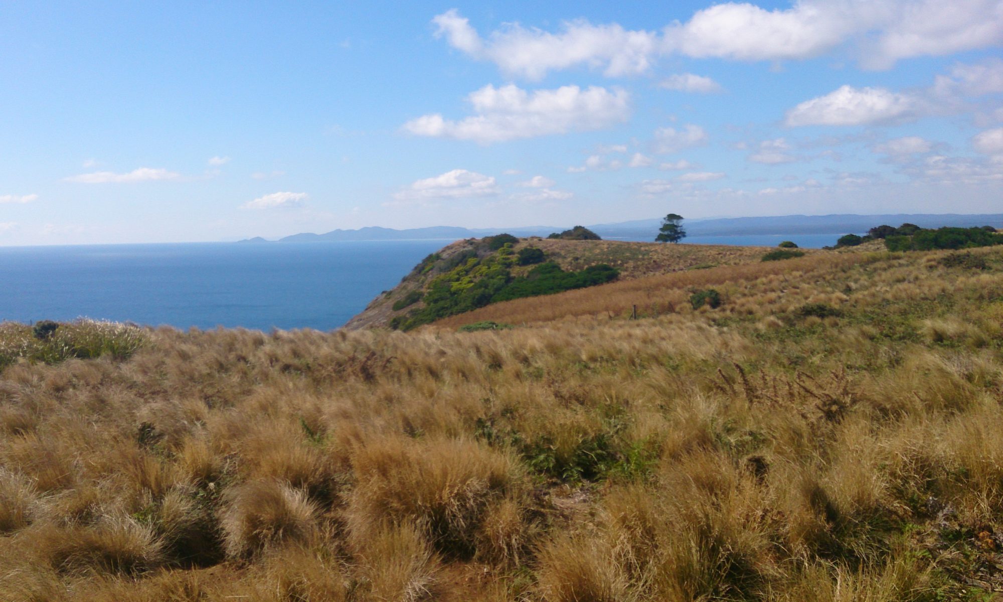
There are two main vantage points. The lower one affords stunning views of Adventure Bay and Fluted Cape. The higher vantage point gives you views of the rest of Cape Queen Elizabeth, down into a crevasse (take care), and on to the shadowy forms of what must be the Tasman Peninsula!

What to Bring

View of Tasman Peninsula
View of Tasman Peninsula © emily@traversingtasmania 2017

As it’s a 3 – 4 Hour walk, you will need to carry at least a litre of water per person, food, sunscreen, a hat, a basic first-aid kit and good walking shoes. From experience, I recommend wearing thick socks and/or bandaging your feet to prevent blisters with newer shoes. I also recommend wearing layers for warmth and taking waterproof gear if rain is forecast. Finally, remember your camera to take some amazing photos! It’s also handy to have your phone with you. I used mine to check tide times and a map of the track on the go.

Getting There

Cape Queen Elizabeth
Cape Queen Elizabeth © emily@traversingtasmania 2017

For directions to Bruny Island, see my instructions at the bottom of my general post about Bruny Island here. Once you’re on Bruny, head south towards The Neck (follow signs from the ferry for Alonnah and Adventure Bay). Before you reach The Neck, you’ll see Bruny Island Honey on the right. Directly opposite this is the car park for the Cape Queen Elizabeth Walking Track. You know you’ve gone too far if you pass the airstrip.

Cost

There is no cost to walk the Cape Queen Elizabeth Walking Track. Make sure that you take care of the track by taking any rubbish that you see out with you.

To read more of my posts about Bruny Island, click here. For posts about southern Tasmania, click here.