East Beach

Traversing East Beach
Low Head Lighthouse
Low Head Lighthouse © emily@traversingtasmania 2017

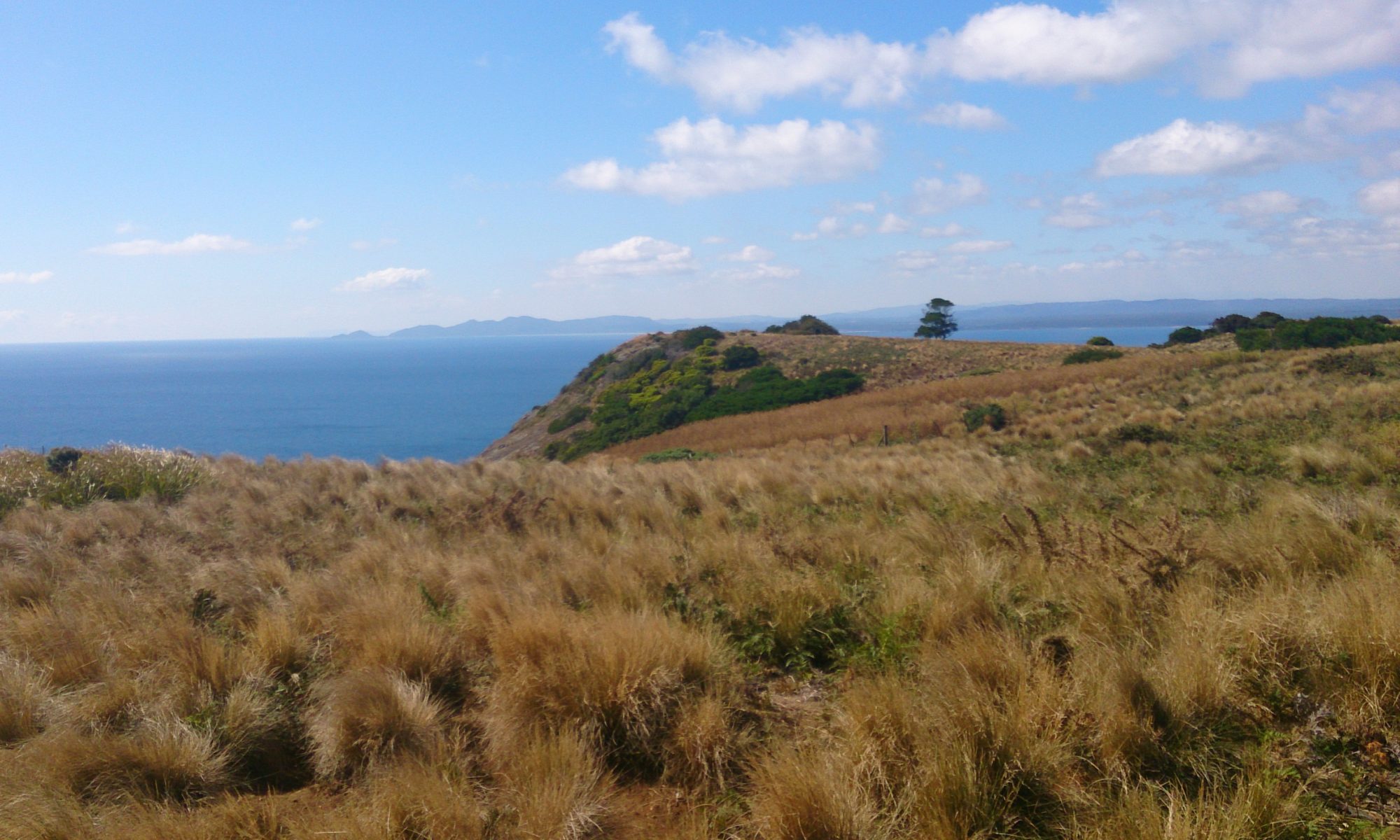
I visited East Beach last week for a quick swim on a hot day. When I arrived, I realised how much I’d forgotten about the location. For one, I’d forgotten that Low Head Lighthouse is visible from the beach. I had also forgotten that there is a giant sand dune at the other end of the beach. As if all of this wasn’t enough, East Beach faces onto Bass Strait. Whichever way you look, it’s a spectacular sight.

Dunes
Dunes © emily@traversingtasmania 2017

East beach is a surf beach. This might make you think twice about going there, particularly with kids, but it is a great beach for swimming. While I was there, kids in floaties swam in the surf with their dad and a toddler played with his father in the shallows. The water was warm and clear, the waves were gentle and the sun shone brightly. I would return there in a heartbeat.

Pebbles
Lichen and Pebbles © emily@traversingtasmania 2017

The beach is also good for exploring. Lichen-covered rocks (like those found at Bay of Fires) can be found at the lighthouse end of East Beach, along with many interesting pebbles and shells. The  dunes are rich with coastal flora and a good walk along the shore will take you to the impressively tall sand dunes.

What to Bring

Dunes
Dunes © emily@traversingtasmania 2017

For an enjoyable day at any beach, always check the weather and wear appropriate clothing. In winter, you’ll need to rug up as the coast can be cold. In summer, bring your bathers so that you can go for a swim (the water is beautiful!) and wear sunscreen and protective clothing. You won’t find a store nearby so bring some food and water. Low Head Pilot Station is three minutes’ drive away and has a café if you’d prefer that.

Getting There

East Beach
East Beach © emily@traversingtasmania 2017

East Beach is about 45 minutes’ drive north of Launceston. Stay on the East Tamar Highway until it turns into Low Head Road. Turn right when you reach Gunn Parade (or East Beach Road – they create a loop). You’ll find ample parking at the beach near the picnic area.

Cost

East Beach Tourist Park
East Beach Tourist Park © emily@traversingtasmania 2017

As with all public beaches in Tasmania, you can access the beach for free. East Beach has a basic toilet and change-room block available for public use. You can also use the adjacent picnic table and barbecue facilities. Nearby East Beach Tourist Park has wood carvings on display that are sure to entertain the kids. Enjoy your day!

On your way to or from East Beach, I recommend visiting Low Head Pilot Station and Lighthouse, the Bass & Flinder’s Centre and Watch House at George Town and Hillwood Berry Farm. I’ve also visited several other places in Tasmania’s north and on the east coast – happy travels!
Alum Cliffs

Traversing Alum Cliffs
Alum Cliffs
Alum Cliffs © emily@traversingtasmania 2017

There are two Alum Cliffs in Tasmania: one in the south and one in the north. I visited the latter, which is located near Mole Creek and Chudleigh on the way from Launceston to Cradle Mountain. Listed as one of Tasmania’s “60 Great Short Walks”, the walk to tulampanga (Alum Cliffs) was indeed short and great!

Views
Views © emily@traversingtasmania 2017

Located in a farming region, the views from between the trees, out over nearby pastures, are rather lovely. I caught a glimpse of the mountains in the distance at one point too. Look around you: A friend saw a falcon in the sky and I spied two gorgeous pink orchids in the bush. There are several interpretive signs to help you better understand the history and significance of the area.

Alum Cliffs Lookout
Alum Cliffs Lookout © emily@traversingtasmania 2017

After 20 minutes, including stops for photos, you’ll find yourself at a small staircase. This leads to the Alum Cliffs Lookout. The view that awaits is at once understated and spectacular. It’s a humble view, of the river below and the cliffs opposite, but it’s impressive because of the sharp angles of the Alum Cliffs, especially in contrast with the surrounding bush. Sit a while and enjoy the view.

What to Bring

Alum Cliffs Track
Alum Cliffs Track © emily@traversingtasmania 2017

It really is a short walk to the Alum Cliffs Lookout so you won’t need to bring much with you. That said, weather in Tassie is unpredictable and we have some critters (snakes, ants, spiders) that can make life unpleasant at times so bringing basic first aid supplies and wearing appropriate clothing is a must on any walk in Tasmania.

Getting There

Alum Cliffs
Alum Cliffs © emily@traversingtasmania 2017

Take the Bass Highway north from Launceston (or south from Devonport), turning onto the B12. Head towards Mole Creek. Shortly after you have passed through the township of Chudleigh, turn right onto Mersey Hills Road. My husband thought that we were lost at this point as the road is narrow and winding. Don’t worry! You will eventually come across a well-signposted carpark on the right-hand side of the road as it takes a sharp bend. You can’t miss it.

Cost

Dusk
Dusk © emily@traversingtasmania 2017

Free, free, free! As this is a reserve, entry to the Alum Cliffs Track is completely free, that is, you don’t need a Parks Pass. Thank you, Parks and Wildlife Tasmania, for providing yet another well-made track, complete with interpretive signs.

While you’re in the area, make sure that you look at the truly gorgeous Mole Creek Caves. Staying a while? Read about my adventures in the surrounding north and north-west areas.

Bridestowe Lavender Estate

Traversing Bridestowe Lavender Estate
Bridestowe Lavender Estate
Bridestowe Lavender Estate © emily@traversingtasmania 2017

I have visited Bridestowe Lavender Estate before, in winter. Even then, it was impressive. In summer, the lavender is in bloom, making the farm a must-see. Fields of purple follow the contours of the land, pointing to the distant Mount Arthur. It is a spectacular sight!

Bridestowe Lavender Estate
Bridestowe Lavender Estate © emily@traversingtasmania 2017

You can wander through the fields for as long as you like. Once the hazy smell of the lavender, the beautiful view of Mount Arthur and the thrill of taking the perfect shot have worn off, there’s more to do. Walk down to the dam, picnic under the oak trees or stroll near the pines, admiring the intriguing statues. When you’re finished, head to the buildings.

Ice-cream!
Ice-cream! © emily@traversingtasmania 2017

You now have choices. Ice-cream first? A lavender blend is available from the very cute truck. What about Devonshire tea? Lavender scones and lavender tea with lavender jam on the side await you in the café. Prefer retail therapy? The Bridestowe Lavender Estate gift store is bursting at the seams with lavender produce, including the famous Bobbie the Bear. When you’re done eating and shopping, join a guided tour.

The Distillery
The Distillery © emily@traversingtasmania 2017

As Bridestowe Lavender Estate is a historic property, the lavender distillery is well worth having a look at. The farm was founded in 1921 and relocated to Nabowla in the mid-1940s. The distillery is a quiet testament to times gone by. You’ll find antique bottles, signs, tins and equipment, as well as a brief explanation of the distilling process.

What to Bring

Lavender Fields
Lavender Fields © emily@traversingtasmania 2017

It sounds obvious, given that you are visiting a farm, but do wear sturdy shoes. Even in summer, it will rain at times and the red earth turns to mud quite quickly! Wear weather-appropriate clothing and take your camera with you. Selfie-sticks are very popular (and useful) but I still can’t bring myself to use one!

Getting There

Mount Arthur
Mount Arthur © emily@traversingtasmania 2017

Bridestowe Lavender Estate is approximately 45 minutes’ drive from Launceston. It is located in Nabowla, which is north-east of Lilydale. Allow extra time for sight-seeing. We stopped at Lilydale Falls Reserve on the way for a short walk as the falls are very peaceful and picturesque. You could also visit one of the well-known wineries in the area, such as Pipers Brook Vineyard or Jansz Tasmania. There is ample parking at Bridestowe Lavender Estate. Instead of driving, you can take a bus (either as a tour or just as public transport) from Launceston to the estate.

Cost

Gift Shop
Gift Shop © emily@traversingtasmania 2017

You’ll pay $10 per person to visit Bridestowe Lavender Estate when the flowers are in bloom. If you are a local or a Friend of Bridestowe (you can sign up for free on Bridestowe Lavender Estate’s website), you’ll get in for free! You can also visit the estate out of season free of charge. The shop and café both have EFTPOS facilities but I’m not sure about the ice-cream truck so take a little bit of cash with you. The estate is open from 9am to 5pm daily (except Christmas Day). Enjoy walking through the fields of lavender and soaking in a little bit more of Tasmania’s unique history.

Staying a while? Read about my adventures in Tasmania’s north and east coast.

Freycinet Adventures

Traversing Freycinet Adventures
The Hazards
The Hazards © emily@traversingtasmania 2017

Recently, we celebrated our wedding anniversary by kayaking into Freycinet National Park with Freycinet Adventures. It was remarkable, bobbing around in the bay and staring up at the Hazards. A lunch stop at a hidden waterfall sealed the deal: I’d do this again!

Kayaks
Kayaks © emily@traversingtasmania 2017

Our guide was very friendly and knowledgeable. At the start of your journey, you’ll receive tips for paddling well as well as the usual safety drills. Traveling in a double-kayak, you’ll depart from Muirs Beach (Coles Bay) and paddle past Picnic Island to Freycinet National Park. In the right season, whales and seals may surface. Your guide will stop the group at several points to discuss the history of the area, including the pink granite quarry.

Waterfall
Waterfall © emily@traversingtasmania 2017

You’ll alight at a hidden cove for a cup of tea and a snack (provided by Freycinet Adventures). The cove houses a gorgeous waterfall. From here, you’ll paddle past Freycinet Lodge and Richardsons Beach. Here, your guide will take a photo of you with the marvellous Hazards in the background. Finally, you’ll sail through the boats moored off Coles Bay on your trip back to Muirs Beach.

What to Bring

View of Picnic Island
View of Picnic Island © emily@traversingtasmania 2017

We did the half-day kayak trip. Wear bathers. While Freycinet Adventures have a policy of “on the water, not in the water”, your bottom will get wet at some point and bathers are much more comfortable! On cooler days, wear polypro or merino thermals for warmth, remembering that it is colder on the water. You’ll be provided with a fleece jacket and a wetsuit skirt. Bring your camera as there’ll be lots of chances for taking photos! Dry bags are provided for storing your electronics. A cuppa and biscuit is also provided for morning tea.

Getting There

Muirs Beach
Muirs Beach © emily@traversingtasmania 2017

Your trip departs from Muirs Beach at the western end of Coles Bay. We booked online but you could also book via Freycinet Adventures’s office, which is located near Muirs Beach. There is no need to head to the office if you have already booked your trip. Just turn up at the beach! Coles Bay is just over two hours’ drive from Launceston via the Midlands and Lake Leake Highways. From Hobart, it’s about a two and a half hour drive via the Tasman Highway. Give yourself plenty of extra time for stops along the way.

Cost

Freycinet National Park
Freycinet National Park © emily@traversingtasmania 2017

In 2017, you’ll pay $98 per adult and $88 per child for the half day tour, which last for approximately three hours. Two and three day tours are also available. Booking online is very straightforward. Payment is processed after your trip in case the trip needs to be cancelled due to poor weather conditions. I’m sure that many a local will scoff at paying for the privilege of kayaking but the staff at Freycinet Adventures make your trip memorable (and not too much hard work!). Included in the cost is your outer layer (fleece jacket and wetsuit skirt), morning or afternoon tea and entry into Freycinet National Park. Of course, use of the kayaks and paddles is included. We had a fabulous time!

For tips on what to do nearby, read my posts about Tasmania’s east coast. If you’re happy to take a longer journey to your destination, I’ve had many an adventure in Tasmania’s south, midlands and north. Happy travels!

Mount Nelson Signal Station

Traversing Mt Nelson Signal Station
Signalmans Cottage
Signalmans Cottage © emily@traversingtasmania 2017

What do Tasmanians like to do on the weekend? Find sunshine, good food, stunning views and a little bit of adventure. The great thing is that you don’t have to travel far to do this in Tasmania. Mount Nelson Signal Station is only a short drive (or a few hours’ walk!) from Hobart’s CBD. Last weekend, I visited the historic site.

Views
Views © emily@traversingtasmania 2017

Mount Nelson Signal Station offers similar views to kunanyi/Mount Wellington but is much closer to the city. Yes, you’re not as high up but you do have a lovely view of the river and the temperature is warmer. In summer, sit out in the sun on a beanbag (perhaps with your dog). In winter, sit on the enclosed verandah of the Signal Station Brasserie. This was formerly the Signalmans Cottage and was built in 1897.

Mount Nelson Signal Station
Mount Nelson Signal Station © emily@traversingtasmania 2017

After you’ve soaked in the sun, there’s more to explore. The Mount Nelson Signal Station lookout house (built in 1910 to replace the 1811 original) hosts a very small but lovely display of historic items. You’ll find signal flags, an Ericsson wall telephone and a semaphore mechanism, as well as other historic artefacts. You’ll also learn more about the story of the signal station. Although its 24+ metre mast has been dismantled and its last message was “forgotten”, the site is not. The lookout house is very picturesque. Take time to admire its round roof, pressed metal ceiling and 180-degree view of the River Derwent.

Mount Nelson Signal Station
Mount Nelson Signal Station © emily@traversingtasmania 2017

There are two lookout platforms at the Mount Nelson Signal Station site. Due to the growth of surrounding trees, you’ll get better views from the carpark! Look up at kunanyi/Mount Wellington or down at the Tasman Bridge and Hobart. If you’ve got a spare few hours, you can even walk down to Sandy Bay or Taroona.

Getting There

View from inside
View from inside © emily@traversingtasmania 2017

Mount Nelson Signal Station is at the upper end of Nelson Road. You can reach it by driving up Mount Nelson from Sandy Bay. This road has several hairpin bends but allows you to see a bit of the history of the area via the houses that line the road. Alternatively, drive out of Hobart towards Kingston on the Southern Outlet or Proctor’s Road, turning left for Mount Nelson at the top of the hill. Whichever road you take, the station is approximately ten minutes’ drive from Hobart’s CBD. There is ample parking on site.

Cost

Signal Station Brasserie
Signal Station Brasserie © emily@traversingtasmania 2017

There is no cost to visit Mount Nelson Signal Station. Completing the walks is also free. There are public toilets and barbeques available for use or you can visit the Signal Station Brasserie. The lookout house is open from 9am – 4pm on weekends (or 10am – 4pm on weekdays).

If you’re staying in the area for a while, I’ve got more ideas for adventures in Tasmania’s south.

Convict Farm Walk

Traversing the Convict Farm Walk
Suspension Bridge
Suspension Bridge © emily@traversingtasmania 2017

Last weekend, we did the Convict Farm Walk between Woolmers and Brickendon estates in Longford. At 45 minutes one way, it’s a relatively short walk through fields with some interesting sights along the way. Being able to walk between the two estates was a treat as I really like both of them.

View from Woolmers
View from Woolmers © emily@traversingtasmania 2017

We set out from Woolmers, out the back gate of the Main House, following signs for the Convict Farm Walk. Here, you’ll have sweeping views of the plains below and the mountains in the distance. You can see Brickendon Farm Village below as a small cluster of buildings. Even if you don’t have time to do the walk, stand on the hillside and take in the view!

Pump House
Pump House © emily@traversingtasmania 2017

At the bottom of the hill, you’ll reach and river and the suspension bridge that spans it. This is open from 9am – 5pm daily. You won’t be able to bring prams, wheelchairs, etc. over the bridge as it is very narrow. It was a lot of fun to walk across its two spans, swinging above the water. Look up and down the river as there are some great views to be had of the pump house from the bridge.

Through the fields
Through the fields © emily@traversingtasmania 2017

From here, it’s about two and a half kilometres to Brickendon. You’ll pass a clay pit (now grassed over) and interpretive signs about the lives and work of the convicts. Take in the views of the Great Western Tiers to your left and the mountains (Ben Lomond, Mount Barrow, etc.) to your right. Walking through wheat stalks and watching the farm in operation was also intriguing. We passed a field of sheep bleating a constant chorus of “maaaaaa!!!” It is an amusing experience to be under surveillance by sheep!!

Jetty
Jetty © emily@traversingtasmania 2017

Take the five-minute detour to the jetty. There’s a lot of serenity with the pump going… watch The Castle if you don’t know what I mean! It is a lovely feeling to be by the water though, watching it flowing past on its way to Longford. From here, it’s a short stroll to Brickendon Farm Village.

Lambs!
Lambs! © emily@traversingtasmania 2017

At Brickendon Farm Village, you’ll find photogenic historic buildings and a whole lot of animals! We said hello to a white horse, large cows, turkeys, geese, ducks, chickens, a pig and, best of all, Spring lambs!!! They were just gorgeous! It took us a long time to leave! One of the staff members spent some time with us, introducing us to the lambs, which was lovely. From the Farm, you can walk on to the homestead at Brickendon (which is a private residence) and surrounding gardens. We chose to head back to Woolmers.

What to Bring

Woolmers Estate
Woolmers Estate © emily@traversingtasmania 2017

You’ll need good walking shoes as, between the two estates and the walk, you’ll spend 3+ hours on your feet. The suspension bridge would also be difficult to cross in inappropriate footwear. Depending on the season, you’ll also need sun protection and/or waterproof clothing. Carry basic first aid supplies, a little bit of food and plenty of water with you. There is a café at Woolmers to relax in and plenty of places to sit down at both ends of the walk.

Getting There

Convict Farm Walk from Brickendon
Convict Farm Walk from Brickendon © emily@traversingtasmania 2017

You can begin the Convict Farm Walk at either estate. Both are about a two-minute drive out of Longford or you can turn into Woolmers Lane directly from the Midlands Highway. You’ll find ample free, all-day parking at both sites. Ask staff at reception for directions to the start of the track.

Cost

White Horse
White Horse © emily@traversingtasmania 2017

If you just wanted to do the Convict Farm Walk, and not look at either site, you could probably do the walk for free. I paid for a self-guided tour of the historic sites at both ends as I like to support local enterprises. Both are worth having a good look around, even if you’ve been before, as they are quite different in each season. Make sure that you tell the receptionist at the second site that you have come from the first as you’ll then get a discount. It cost us $24 per adult to visit both sites and do the Convict Farm Walk, which I think is very reasonable!

Enjoy your time at Woolmers and Brickendon! I’ve visited several places in Tasmania’s nearby midlands, north and central highlands if you’re interested in more ideas for your own adventures.