Cataract Gorge Reserve

Traversing Cataract Gorge Reserve
Cataract Gorge Reserve
Cataract Gorge Reserve © emily@traversingtasmania 2017

Launceston’s Cataract Gorge Reserve (“The Gorge” to locals) is a unique place. Carved out by the mangana lienta (South Esk River), the gorge is a stunning, dolerite landscape. The south side of the river is a dry forest and is accessible via the Zig Zag Track (for hikers). The north side resembles a rainforest and has a sealed path. The Gorge is a popular area for walking, picnics, swimming (in summer) and spending time with family and friends.

Walkway
Walkway © emily@traversingtasmania 2017

We parked at Kings Bridge and walked on the sealed path to the Cliff Grounds. This walk is very picturesque. You first encounter the bridge, an entryway and then a house that seems to cling to the cliff. Artists in residence live here. Along the pathway, there are many sights to see, including native flora, rapids and a hut made by two local gentlemen in the mid-1900s. It is a peaceful walk. You can also take a short cruise up the river.

Wallabies
Wallabies © emily@traversingtasmania 2017

As we entered the Cliff Grounds, we saw three wallabies. They are beautiful creatures and were very tame. Please do not feed them processed food as doing this can cause lumpy jaw. I highly recommend that you read Parks and Wildlife’s information on interacting with wild animals. It is just as satisfying to take a photograph from a distance. These wallabies were very good posers!

Cliff Grounds
Cliff Grounds © emily@traversingtasmania 2017

The Cliff Grounds were “beautified” by locals in the late 1800s. They built pathways and the gorgeous Victorian structures that are dotted about The Gorge, including the rotunda. This now contains information about the history of the Gorge and Cliff Grounds. Near the rotunda, you’ll find the path to the Gorge Scenic Chairlift. This boasts the longest span in the world! I’ll have to ride it next time I visit but ran out of time today.

Peacock
Peacock © emily@traversingtasmania 2017

There are several species of trees to admire, including approximately seventy native species. There are also seventy species of native birds to admire. Although they are introduced species, there is something wonderful about walking beneath towering maples, oaks and elms. There are also plenty of peacocks to entertain you (I grew up with peacocks so I’m not so fond of them!). I spotted three peacocks on the roof of the restaurant when we left the Cliff Grounds. The Gorge Restaurant is open daily from 9am and a kiosk is also open during the day.

Bridge
Bridge © emily@traversingtasmania 2017

From the Cliff Grounds, head downhill, following signs for The Basin Walk. This will lead you across a small footbridge (with no rails) from which you can admire the rapids, the First Basin and the suspension bridge. It’s a short walk from here to the Basin Cafe, above which is the other end of the chairlift. The Cafe has an excellent view. It is situated above an amenities block, which is designed to cater for summer swimmers.

First Basin
First Basin © emily@traversingtasmania 2017

In summer, you’ll find lovely clean water in the pool and life guards to boot. Locals also swim in the First Basin, but this is not recommended due to the submerged rocks and the depth. It is about 20 metres deep, although I have been told that the bottom hasn’t yet been located… I was brave enough to get in on a hot day some years ago, albeit with a pool noddle for safety!

Alexandra Suspension Bridge
Alexandra Suspension Bridge © emily@traversingtasmania 2017

From the Basin Cafe, walk towards the suspension bridge, along an unsealed path. Built in 1940, the Alexandra Suspension Bridge is very elegant and the views up and down river from it are stunning. Some people (including me!) will swing the bridge from side to side as they walk across it. If you don’t like heights, wait until you’re the only one around before crossing. A short distance from the bridge, climb the set of stairs leading up to a viewing platform. Again, the view is wonderful.

Getting There

Cataract Gorge Reserve
Cataract Gorge Reserve © emily@traversingtasmania 2017

Cataract Gorge Reserve is about a 15 – 30 minute walk from Launceston’s CBD. Paid parking (or free street parking if you are prepared to walk a little further) is available just off Basin Road in West Launceston. Limited free parking is available near the Cliff Grounds (Trevallyn) and limited paid parking is available near Kings Bridge at Penny Royal Adventures or on the street.

Cost

Cataract Gorge Cruises
Cataract Gorge Cruises © emily@traversingtasmania 2017

It does not cost anything to explore Cataract Gorge Reserve or to swim in the pool (when it is open in summer). You can also use the public barbecues, picnic areas, amenities and playground equipment for free. We brought a picnic lunch with us. Alternatively, purchase lunch from the Basin Cafe or book a table in The Gorge Restaurant. Cataract Gorge Reserve is a very special place. Enjoy your visit!

Want more ideas about what else to do nearby? Read about my experience Cataract Gorge Cruises and my adventures in Tassie’s north and midlands.
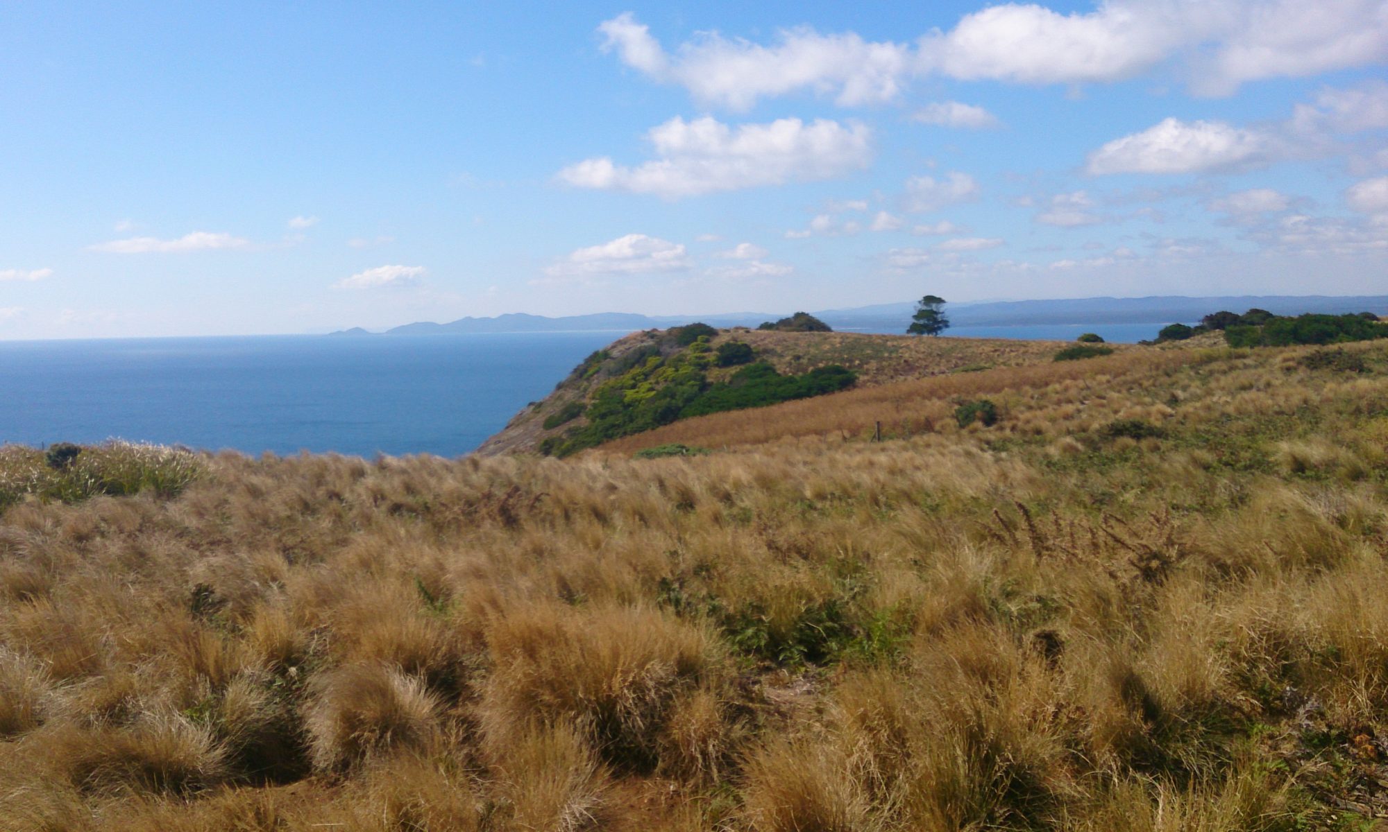
Bay of Fires

Sunrise, Bay of Fires
Bay of Fires
Bay of Fires © emily@traversingtasmania 2017

Bay of Fires was named by explorer Tobias Furneaux who sailed by in 1773 and saw the fires lit by the Aboriginal people. These promoted plant growth and kept mammals, an important food-source, close to the coast. The area continues to be an important place for the Tasmanian Aboriginal community. A large midden at one end of Jeanneret Beach has yielded many Aboriginal artifacts. Another sacred site in the area is larapuna (Eddystone Point), which is also a large midden. Respect these sacred sites by adhering to signage and fencing.

Binalong Bay
Binalong Bay © emily@traversingtasmania 2017

Today, the Bay of Fires is renowned for granite rocks covered with fiery orange lichen. It is also famous for its pure white sand and turquoise waters.  Due to its unique flora and fauna, the Bay of Fires is a conservation area. You can access approximately half of the coast by car. It is much harder to access the northern half of Bay of Fires in Mount William National Park. You can walk through with local tourism companies or you can sail past like Furneaux. I saw the area from the water on a Bay of Fires Eco Tours cruise, which you can read about here.

Taylors Beach
Taylors Beach © emily@traversingtasmania 2017

The southern part of the Bay of Fires Conservation Area stretches from Binalong Bay through to The Gardens and contains several excellent campsites. You can camp here for up to four weeks at a time. Amenities are limited (drop toilets) and you will need to bring your own water but the location is sensational! If you have a motorhome, Swim Cart beach gives you an amazing view and excellent beach access for surf fishing (swimming is not advised). The most popular camping site is Cosy Corner. For more information about camping in the Bay of Fires, see the Parks and Wildlife website.

Shacks, Taylors Beach
Shacks, Taylors Beach © emily@traversingtasmania 2017

There are many holiday rentals in Binalong Bay or the area near The Gardens. I’ve found that renting directly from an owner (when possible) is a better experience. There are no general stores in the Bay of Fires area so pick up supplies in nearby St. Helens on your way in. You can purchase a coffee at Moresco Restaurant or the Bay of Fires Eco Tours at Titley’s Shack.

Grants Lagoon
Grants Lagoon © emily@traversingtasmania 2017

The beauty of the Bay of Fires is that it is largely uncommercialised. You can cruise the bay (read about my experience here) or do a four-day walking tour departing from Launceston. There is also a viewing platform and information boards at The Gardens. You’ll be swimming, kayaking, fishing, walking the pristine beaches, encountering the wildlife and just taking in one of the most picturesque places on the planet.

Getting There

The Gardens
The Gardens © emily@traversingtasmania 2017

Bay of Fires is about a three-hour drive from Launceston and a four-hour drive from Hobart. From Launceston or Hobart, take the Midlands Highway to Campbell Town then turn onto the Lake Leake road to the East Coast. Alternatively, drive northeast from Launceston to Scottsdale (via Lilydale or Myrtle Park). If driving from Hobart, you can follow the coast the entire way. Wherever you are travelling from, allow yourself additional time to explore the regions that you are passing through as there are some top-notch attractions along the way.

Cost

Binalong Bay
Binalong Bay © emily@traversingtasmania 2017

There is no cost for visiting the southern section of the Bay of Fires Conservation Area from Binalong Bay to The Gardens. If you choose to visit Mount William National Park, you need to have a Parks Pass. You can enjoy the Bay of Fires for a relatively low cost if you are camping or having a day at the beach. Enjoy the pristine waters and beautiful wildlife of the Bay of Fires!

Read about my other journeys on Tasmania’s stunning east coast here.

Bruny Island

Traversing Bruny Island

Bruny Island lies off the coast of Southern Tasmania, about half an hour’s drive south of Hobart. It is roughly 100 kilometres long and boasts some of Tasmania’s finest produce, wilderness and attractions.

View from The Neck
View from The Neck © emily@traversingtasmania 2017

The island is divided into two halves: North Bruny and South Bruny. The ferry from Kettering (mainland Tasmania) arrives at Roberts Point on North Bruny. There are small settlements at the beautiful Dennes Point and Barnes Bay (follow signs from the ferry terminal). If you keep driving south, you’ll end up at the cheese factory, oyster bar and scenic flight base. Once you’ve passed these places, you will arrive at a thin strip of land joining North and South Bruny: The Neck.

The Neck
The Neck © emily@traversingtasmania 2017

It is worth stopping at The Neck, even if you’ve been to Bruny Island before. Climb the wooden stairs and see the ever-changing view of Bruny. You should also read the information about the original inhabitants of Bruny Island such as Truganini. If you are at The Neck at dusk, stop and watch the penguins emerging from the water. Take a red-light torch for optimal viewing without disturbing the penguins too much and make sure that you keep to the paths rather than damaging the penguins’ burrows.

Adventure Bay
Adventure Bay © emily@traversingtasmania 2017

Heading south from The Neck, you have choices! You could turn left to Adventure Bay. This is a beautiful, sweeping bay with stellar views, a caravan park and a nice little café (The Penguin). You can also catch a Pennicott Wilderness Journeys’ Bruny Island Cruises tour from Adventure Bay (read about my experience here) or you can walk to the ruins of the whaling station at Grass Point. There is a general store with an ATM at Adventure Bay.

Cloudy Bay Lagoon
Cloudy Bay Lagoon © emily@traversingtasmania 2017

If, instead, you turn left after The Neck, you’ll find your way to Alonnah and Lunawunna. lunawunna allonnah is the Aboriginal name for Bruny Island. At Alonnah, Hotel Bruny has a lovely view and serves a fine meal, happily catering for dietary requirements upon request. There is also a general store and History Room at Alonnah. After driving through Lunawunna, you have two choices. You can turn left towards Cloudy Bay for excellent camping and surfing, as well as access to South Bruny National Park. Or, you can turn right towards Cape Bruny Lighthouse (you can read about my experiences here), as well as access to another part of South Bruny National Park.

Barnes Bay
Barnes Bay © emily@traversingtasmania 2017

Wherever you choose to be on Bruny, you can expect good food, superb scenery and space to relax. Make sure that you check opening hours as some places vary their hours seasonally. Take a good book, a bit of cash, a full tank of petrol and clothes for all seasons and you’ll have a lovely time.

Getting There

Mirambeena
Mirambeena © emily@traversingtasmania 2017

If you have a car, simply take the vehicle ferry from Kettering. The current timetable is available here; make sure that you arrive 30 minutes prior to your scheduled departure and that you bring cash or a payWave capable card (EFTPOS or credit cards requiring pins/signatures cannnot be used). While petrol is available at some locations on Bruny, fill your car up before you venture over for maximum relaxation time. Hire cars can be problematic. Some hire car companies won’t allow you to drive their vehicles on Bruny Island due to the amount of dirt roads and consequent traffic incidents involving inexperienced drivers. Your GPS system may also cut out as phone reception has “black spots” on Bruny Island. Everything is well sign-posted though. If you’d prefer not to take a car onto Bruny, book a tour with one of the local companies.

Cost

Bruny Island's southern tip
Bruny Island’s southern tip © emily@traversingtasmania 2017

Getting to Bruny currently costs $33 per car (prices are seasonal and dependent on vehicle size; click here for current rates). Food, supplies, fuel etc. are all reasonably priced, considering that you’re on a small island, but accommodation can be a bit expensive. You’re paying for the privilege of staying on Bruny. It’s a unique, unforgettable island and is well worth a visit… and another visit… and another…

To read more about my travels in Tasmania’s south, click here.

Cape Bruny Lighthouse

Traversing Cape Bruny Lighthouse
Cape Bruny
Cape Bruny © emily@traversingtasmania 2017

Cape Bruny Lighthouse is a sturdy yet elegant lighthouse. Due to being made from sterner stuff than other historic lighthouses, it now boasts being the second oldest original lighthouse in Australia. It was Australia’s fourth lighthouse at its time of lighting in 1838. Constructed by convicts from local dolerite, the lighthouse took just 18 months to build. The three keepers cottages still sit below it, as does a graveyard, the ruins of a convict vegetable garden and some of the best scenery in the world.

Cape Bruny Lighthouse
Cape Bruny Lighthouse © emily@traversingtasmania 2017

Cape Bruny Lighthouse is a monument to times gone by. Now replaced by an automated light on the tip of the cape, the old lighthouse was recently restored internally and opened to the public for tours. You can book a tour online or at the base of the lighthouse on the day. Tours go up the tower every half hour. We had a private tour, which was lovely. The guide was friendly and knowledgeable. His boss grew up in various lighthouses around the state as the child of one of Tasmania’s last lighthouse keepers.

Fresnel prism
Fresnel prism © emily@traversingtasmania 2017

Inside, you’ll find a beautiful metal spiral staircase, the original Fresnel prism, kerosene vents, the weight system used for keeping the light revolving and a working phone to the keeper’s cottage. You end up circling the lighthouse on its balcony. We saw a wedge-tail eagle from above (they have a stunning pattern on their wings which you can’t see from the ground). It is breathtaking to view the D’Entrecasteaux Channel, the Southern Ocean and the southern tip of Bruny Island from above.

Cape Bruny
Cape Bruny © emily@traversingtasmania 2017
The Lighthouse Station
The Lighthouse Station © emily@traversingtasmania 2017

Once you are on the ground again, enter the museum for a glimpse of the machinery that made it all happen. The museum also houses artefacts found on site (ceramics, name plates, etc.). From the left-hand side of the Number 1 Keepers Cottage, take a walk down to the beach, past a small graveyard and the ruins of a convict garden. The Tasmanian flora in South Bruny National Park is magnificent. Watch out for my least favourite of all Tasmanian fauna: the Tasmanian Tiger snake. If you do come across one, make a decision to run or stand very still and make sure that you commit to your decision 100% as half-doing either option is not worth it!

Getting There

Convict Garden
Convict Garden © emily@traversingtasmania 2017

To get to Bruny Island, follow the advice in my Bruny Island post. Drive south from Alonnah, turning right at the T-junction near Lunawanna. Follow signs for Cape Bruny Lighthouse. The road is primarily gravel and is quite rough. There are two scenic lookouts on the way; stop at both. There is parking at the lighthouse although it is only a small carpark so you may have to park alongside the road – don’t block the driveways to the keepers cottages as two of these contain residents (the third is the museum).

Cost

View from the Lighthouse
View from the Lighthouse © emily@traversingtasmania 2017

Tours up the lighthouse (highly recommended!) are $10 per adult, $7.50 per child or $35 per family (not suitable for children under 5 years old).  You can book your tickets online here. This is recommended as tours can book out because they are for only eight people at a time. If you do book online, keep your booking number to quote for the guide. For those who arrive at Cape Bruny Lighthouse without a booking, it is worth the half hour wait. The views from the lighthouse are spectacular.

To read more about my travels in Tasmania’s south, click here.

Notley Fern Gorge State Reserve

Traversing Notley Fern Gorge
Notley Fern Gorge State Reserve
Notley Fern Gorge © emily@traversingtasmania 2017

Notley Fern Gorge State Reserve is a unique place. You’ll find at least four varieties of fern, towering trees, Tasmanian native animals, and the giant, hollowed-out tree that bush-ranger Matthew Brady and his band of followers sheltered in during the 1820s.

White Gum Tree
White Gum Tree © emily@traversingtasmania 2017

Notley Fern Gorge is accessed via a circuit walk which supposedly takes one hour (I completed it in 35 minutes and stopped to take plenty of photos). The track is well-defined, with steps up and down the hill and bridges across the stream. You head down the hill (whichever way takes your fancy) and loop back up after walking through the gorge. It is amazing how different the flora is at the bottom of the gorge from that at the top of the hill; look out for fungus growing on fallen logs, fairy-tale moss-covered trees and plenty of ferns. Signs help you to identify the various plants, including common filmy ferns, hard water ferns, kangaroo ferns and mother shield ferns. Above the ferns are trees soaring into the sky, including white gums and blackwoods. It’s a very peaceful place.

Notley Fern Gorge State Reserve
Notley Fern Gorge © emily@traversingtasmania 2017
Brady's Tree
Brady’s Tree © emily@traversingtasmania 2017

If you’re not very steady on your feet (the ground is covered in leaf litter year-round which can be quite slippery) and don’t feel up to walking the full loop, Brady’s Tree is only five minutes’ walk from the car park. A hollowed, burnt out tree, this is reputedly where Brady and his men sheltered from the authorities about 200 years ago. It’s a fun place for kids to explore. There is also another hollowed-out tree nearby (just a few metres further down the hill).

Getting There

Information Shelter
Information Shelter © emily@traversingtasmania 2017

Notley Fern Gorge State Reserve is located on Notley Gorge Road. From Launceston, head north on the West Tamar Highway. When you reach Legana, turn left onto Bridgenorth Road and then, after about 10 minutes, turn right onto Notley Gorge Road (C731). Ignore Google Maps and, if you’re using it to estimate travel time, add about five minutes. The turnoff to the reserve is signposted (although overgrowth can make it hard to see the sign from a distance). You can also read Notley Gorge Road from Frankford Road (it’s the right turn shortly after Glengarry as you travel towards Exeter). There is a car park, toilet and information shelter at the reserve.

Cost

Bridge, Notley Fern Gorge
Bridge, Notley Fern Gorge © emily@traversingtasmania 2017

There is absolutely no cost to visit Notley Fern Gorge State Reserve. Parks and Wildlife Tasmania do an excellent job of keeping the track in good order. Please respect their conservation work by keeping to the tracks and taking your rubbish with you.

Will you see an animal at Notley Fern Gorge State Reserve? Almost certainly. I saw two lizards and a native bird (sorry Mum; I’m still not a very good bird-spotter!). Will you see a mammal? Maybe. A bandicoot dashed across the track in front of me, too fast for me to take a photograph, and I heard a wallaby thumping through the undergrowth. If you visit at dawn or dusk, you’re more likely to see wildlife (including on the roads, so drive slowly and carefully!). We have previously visited the reserve during spring and saw a few pairs of mother and baby wallabies so I highly recommend a spring visit! Even if you don’t see a native mammal, Notley Fern Gorge is a beautiful place. If you’re driving through the Tamar Valley, you should definitely stop and take in a small slice of native Tasmania.

For more posts about places to visit in northern Tasmania, click here.

Mole Creek Caves

Traversing Tasmania, Mole Creek Caves
King Solomons Cave © emily@traversingtasmania 2017

How do you cool off on a hot summer’s day? Go to a place where the temperature is a cool 9°C year-round, that’s what. A place where straws, stalactites and glow worms are suspended above your head. Go where calcite crystals have grown in the dark over many, many years. Mole Creek Caves provided a magnificent refuge today, but our visit involved much more than just escaping the heat!

Mole Creek Caves

Both King Solomons Cave and Marakoopa Cave were discovered in 1906. King Solomons was found by two men chasing an unlucky wallaby. Marakoopa was found by two boys. A few years later, both caves were open to the public for tours. You can still see the oil burner used to light King Solomons Cave (which has left its inevitable mark on the crystals).

Stalactites, King Solomons Cave © emily@traversingtasmania 2017

King Solomons Cave is a compact gem. When our guide turned on the lights, looking up to see stalactites was a breathtaking experience! King Solomons Cave contains a variety of magnificent calcite crystal formations, winding passageways and a stunning larger chamber. Here, you can see the original entrance to the cave and the oil burner. We even saw a Tasmanian Cave Spider, which is a very intriguing creature!

Marakoopa Cave © emily@traversingtasmania 2017

Marakoopa Cave is a much larger cave and has two tours. Both tours include the beautiful glow worms, which are found only in the Eastern states of Australia and in New Zealand. The first Marakoopa Cave tour takes you to its underground rivers and the second takes you up to the “Cathedral” formations. We took the second tour, which requires a higher fitness level due to having to climb a large number of stairs. We passed several magnificent flow stones, a swinging pendulite (perhaps the only one in the world!) and several magnificent shields. All of this was lit up by the brand new lighting system (replaced due to recent flooding). We saw glow worms in almost every chamber of the cave. Five glow worms had even arranged themselves in the shape of the Southern Cross, a very patriotic move on Australia Day!

Getting There

Mole Creek Karst National Park © emily@traversingtasmania 2017

The drive to Mole Creek Caves is an amazing experience in and of itself. Driving along the Bass Highway from either Devonport or Launceston takes you past several excellent food establishments and gives you a fabulous view of the Great Western Tiers. This view only improves as you drive along the B12 road to Mole Creek, passing boulder-strewn paddocks that are nestled up against the mountains. Both caves are located in the Mole Creek Karst National Park and both have fern glade walks near their entries (these are short but well worth doing). The turn off to Marapooka Cave and the main ticket office appears first and is clearly signposted. If you follow the B12 a little further, King Solomons Cave is the first turn to the right.

Cost

Marakoopa Cave © emily@traversingtasmania 2017

Tickets can be purchased from the ticket office near Marakoopa Cave or, via card only, from King Solomons Cave and you do not need a Parks Pass if you purchase a cave tour ticket. The cost for cave tours is currently $19 per adult ($15.50 concession) and $9.50 per child for one cave tour. See Parks and Wildlife for more information about prices. The cost is well worth it. Facilities have recently been updated (note that the toilets at Marakoopa Cave are now located at the ticket office, which is 500m from the cave) and the caves are such a unique experience! Further to this, extensive work has recently been done due to major flooding (Marakoopa Cave was closed for approximately six months). So, escape from the sun in summer and the wind in winter by going underground!

Read more about my adventures in Tasmania’s north here, or in the north west here.