Goat Island

Traversing Goat Island
Goat Island
Goat Island © emily@traversingtasmania 2017

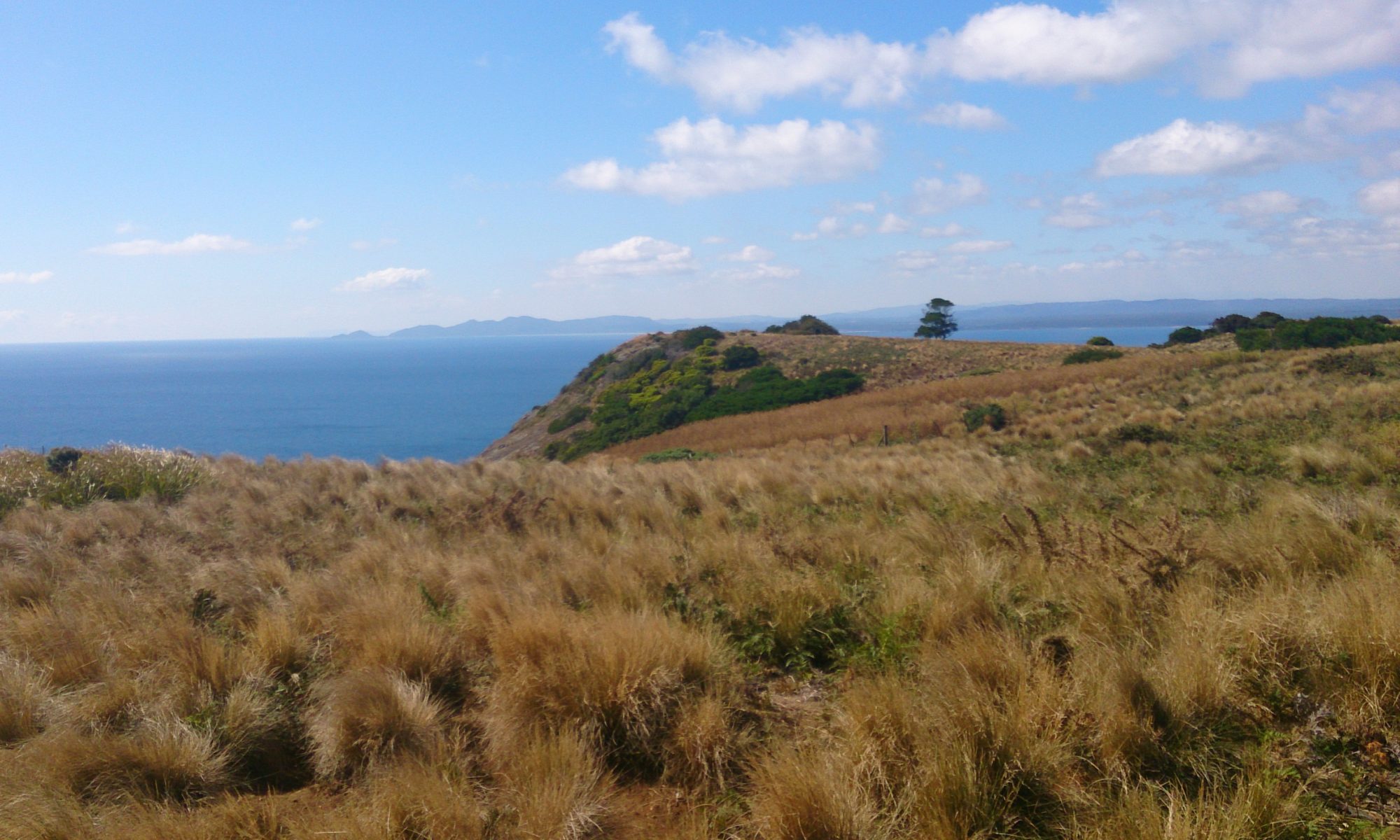
Just a hop, skip and a jump from mainland Tasmania lies Goat Island. This two-peaked wonderland can be walked to at low tide across a rocky shelf. It is a geologist’s, photographer’s and inner-child’s paradise! You can see east to Ulverstone or west to the Three Sisters as well as discovering wonderful views beneath your feet. I ran around on the rock shelf like a happy kid (no pun intended!) for quite some time before reaching Goat Island proper.

On the island
On the island © emily@traversingtasmania 2017

While I’m not sure where the island got its name, Mr. Traversing Tasmania is a bit of a mountain goat, so he demonstrated one possibility by scampering up the steep, rocky slopes. I stayed down a little lower on “safer” ground but somehow managed to slip anyway! Small tracks will lead you around Goat Island, to the peaks, a cove and a very special cave.

Bass Strait
Bass Strait © emily@traversingtasmania 2017

I’ll get to the cave. First, you must explore the rocky cove with wonderful views of Bass Strait. I found two fascinating rock pools, perhaps the best I’ve ever seen, on top of a rocky ledge. The patterns and textures of Goat Island are incredible. Jagged edges, fiery lichen, unusual seaweed, muscles… the island has it all. To the rear of the cove is a stand of trees covered in vines. It’s a surreal place.

Cave
Cave © emily@traversingtasmania 2017

Walking east around the rocks from the cove, you’ll find the cave. This cave is very unusual because you can crawl through it, there’s a rock pool inside it and it is heart-shaped. Before you get all swoony, the very non-romantic feature of the cave is its fly population. They are in plague proportions. Yuck! Mr. Traversing Tasmania crawled through the cave anyway. Be aware that you will need to climb down the heart-shaped side – don’t rush away from the flies too fast!

Lichen
Lichen © emily@traversingtasmania 2017

The tide will come in, as it always does. You can find updates about the tides here (note that the page shows information for nearby Picnic Point Beach). You want to visit Goad Island when the tide is at a low point (or shortly before this). Do not lose track of time on the island. This is dangerously easy to do but will see you stranded there. While I have no doubt that this would be an adventure in and of itself (and would make for great photos), you’ll miss out on the many other beautiful sights in nearby Ulverstone and Penguin.

What to Bring

Two Peaks
Peaks © emily@traversingtasmania 2017

You’ll need sturdy shoes. The rocks are sharp and you won’t make it over the rock shelf to the island (or around the island to the cave) without them. I always take a back-pack with first aid necessities and I take weather-appropriate gear too. Leave your bathers in the car because this island is for exploring, not relaxing or swimming! Make sure that you bring your camera every part of the island is ridiculously photogenic.

Getting There

Three Sisters
Three Sisters © emily@traversingtasmania 2017

You’ll find Goat Island on Penguin Road, which is the old highway between Ulverstone and Penguin along the coast. Follow Queen Street out of Ulverstone, driving for about five minutes, or Main Road out of Penguin, driving for about ten minutes. Look for signs to Goat Island. There is a small car park across the railway lines but take care as trains do use the railway. Your visit will be restricted by the tide but, if you time it right, you’ll have a lovely experience.

Cost

Cave
Cave © emily@traversingtasmania 2017

Tasmania really is a fabulous place and much of it can be explored for free. Goat Island is no exception. Perhaps you could respect this privilege by taking any litter you find with you. Have a grand adventure on a very unusual island!

Staying in the area for a while? There’s more to see in Tasmania’s north west, north and west coast.
Greens Beach

Traversing Greens Beach
Our swimming spot...
Our swimming spot… © emily@traversingtasmania 2017

Two days ago, we went for a beautiful swim at Greens Beach. Following the coastal track around to a rocky outcrop, the water was clear, cool and deep. We saw a school of tiny fish, a jellyfish and something that looked pufferfish-esque. Today, the tide was out. Way out. A lady sat in a deck-chair in the exact spot that I had been out-of-my-depth in the ocean two days before. Welcome to Greens Beach!

Low tide
Low tide © emily@traversingtasmania 2017

Greens Beach is very popular with families. When the tide is in, its shallow expanse makes for warm water and a kind environment for beginner swimmers. If you like deeper water, walk out on the coastal track or on the rocks. When the tide is out, my only recommendation is to get in (once you’ve made the long walk across the sand to the water!) and enjoy yourself. If swimming isn’t your thing, you can walk along the beach or around the headland to West Head Lookout. There’s also a nearby golf course if you prefer a different sort of walk.

Lichen
Lichen © emily@traversingtasmania 2017

Views of Low Head Lighthouse make Greens Beach very picturesque. Like East Beach (on the other side of the Tamar River), you’ll also see the distinctive orange of lichen covered rocks. There are more treasures to be found in the rock pools.

What to Bring

Greens Beach
Greens Beach © emily@traversingtasmania 2017

Bring all the usual beach gear – towel, swimmers, sun-protective gear, water, friends, flotation devices and, of course, your deck chair. The takeaway shop across the road was doing a roaring trade when we visited the beach; I hear that they do very good chips.

Getting There

View of Low Head Lighthouse from the rocks
View of Low Head Lighthouse from the rocks © emily@traversingtasmania 2017

It’ll take you about 50 minutes to drive from Launceston to Greens Beach on the West Tamar Highway. Stay on the highway until Beaconsfield. After the petrol station in Beaconsfield, turn left, following signs for Greens Beach (C720). If you do stay on the A7, you’ll just take a scenic tour to Beauty Point (which I highly recommend!) before making it to Greens Beach. You’ll find parking spaces at the beach front and in nearby streets.

Cost

Swimming
Swimming © emily@traversingtasmania 2017

All public beaches in Tasmania are free to access. You can also use the barbecues and amenities for free. If you’re feeling particularly sporty, there’s exercise equipment to use and there’s also a playground for the kids. All in all, Greens Beach is a great place to go adventuring!

Staying in Tasmania? There’s plenty to explore in the nearby north, midlands and north west regions.

East Beach

Traversing East Beach
Low Head Lighthouse
Low Head Lighthouse © emily@traversingtasmania 2017

I visited East Beach last week for a quick swim on a hot day. When I arrived, I realised how much I’d forgotten about the location. For one, I’d forgotten that Low Head Lighthouse is visible from the beach. I had also forgotten that there is a giant sand dune at the other end of the beach. As if all of this wasn’t enough, East Beach faces onto Bass Strait. Whichever way you look, it’s a spectacular sight.

Dunes
Dunes © emily@traversingtasmania 2017

East beach is a surf beach. This might make you think twice about going there, particularly with kids, but it is a great beach for swimming. While I was there, kids in floaties swam in the surf with their dad and a toddler played with his father in the shallows. The water was warm and clear, the waves were gentle and the sun shone brightly. I would return there in a heartbeat.

Pebbles
Lichen and Pebbles © emily@traversingtasmania 2017

The beach is also good for exploring. Lichen-covered rocks (like those found at Bay of Fires) can be found at the lighthouse end of East Beach, along with many interesting pebbles and shells. The  dunes are rich with coastal flora and a good walk along the shore will take you to the impressively tall sand dunes.

What to Bring

Dunes
Dunes © emily@traversingtasmania 2017

For an enjoyable day at any beach, always check the weather and wear appropriate clothing. In winter, you’ll need to rug up as the coast can be cold. In summer, bring your bathers so that you can go for a swim (the water is beautiful!) and wear sunscreen and protective clothing. You won’t find a store nearby so bring some food and water. Low Head Pilot Station is three minutes’ drive away and has a café if you’d prefer that.

Getting There

East Beach
East Beach © emily@traversingtasmania 2017

East Beach is about 45 minutes’ drive north of Launceston. Stay on the East Tamar Highway until it turns into Low Head Road. Turn right when you reach Gunn Parade (or East Beach Road – they create a loop). You’ll find ample parking at the beach near the picnic area.

Cost

East Beach Tourist Park
East Beach Tourist Park © emily@traversingtasmania 2017

As with all public beaches in Tasmania, you can access the beach for free. East Beach has a basic toilet and change-room block available for public use. You can also use the adjacent picnic table and barbecue facilities. Nearby East Beach Tourist Park has wood carvings on display that are sure to entertain the kids. Enjoy your day!

On your way to or from East Beach, I recommend visiting Low Head Pilot Station and Lighthouse, the Bass & Flinder’s Centre and Watch House at George Town and Hillwood Berry Farm. I’ve also visited several other places in Tasmania’s north and on the east coast – happy travels!

Alum Cliffs

Traversing Alum Cliffs
Alum Cliffs
Alum Cliffs © emily@traversingtasmania 2017

There are two Alum Cliffs in Tasmania: one in the south and one in the north. I visited the latter, which is located near Mole Creek and Chudleigh on the way from Launceston to Cradle Mountain. Listed as one of Tasmania’s “60 Great Short Walks”, the walk to tulampanga (Alum Cliffs) was indeed short and great!

Views
Views © emily@traversingtasmania 2017

Located in a farming region, the views from between the trees, out over nearby pastures, are rather lovely. I caught a glimpse of the mountains in the distance at one point too. Look around you: A friend saw a falcon in the sky and I spied two gorgeous pink orchids in the bush. There are several interpretive signs to help you better understand the history and significance of the area.

Alum Cliffs Lookout
Alum Cliffs Lookout © emily@traversingtasmania 2017

After 20 minutes, including stops for photos, you’ll find yourself at a small staircase. This leads to the Alum Cliffs Lookout. The view that awaits is at once understated and spectacular. It’s a humble view, of the river below and the cliffs opposite, but it’s impressive because of the sharp angles of the Alum Cliffs, especially in contrast with the surrounding bush. Sit a while and enjoy the view.

What to Bring

Alum Cliffs Track
Alum Cliffs Track © emily@traversingtasmania 2017

It really is a short walk to the Alum Cliffs Lookout so you won’t need to bring much with you. That said, weather in Tassie is unpredictable and we have some critters (snakes, ants, spiders) that can make life unpleasant at times so bringing basic first aid supplies and wearing appropriate clothing is a must on any walk in Tasmania.

Getting There

Alum Cliffs
Alum Cliffs © emily@traversingtasmania 2017

Take the Bass Highway north from Launceston (or south from Devonport), turning onto the B12. Head towards Mole Creek. Shortly after you have passed through the township of Chudleigh, turn right onto Mersey Hills Road. My husband thought that we were lost at this point as the road is narrow and winding. Don’t worry! You will eventually come across a well-signposted carpark on the right-hand side of the road as it takes a sharp bend. You can’t miss it.

Cost

Dusk
Dusk © emily@traversingtasmania 2017

Free, free, free! As this is a reserve, entry to the Alum Cliffs Track is completely free, that is, you don’t need a Parks Pass. Thank you, Parks and Wildlife Tasmania, for providing yet another well-made track, complete with interpretive signs.

While you’re in the area, make sure that you look at the truly gorgeous Mole Creek Caves. Staying a while? Read about my adventures in the surrounding north and north-west areas.

Mount Nelson Signal Station

Traversing Mt Nelson Signal Station
Signalmans Cottage
Signalmans Cottage © emily@traversingtasmania 2017

What do Tasmanians like to do on the weekend? Find sunshine, good food, stunning views and a little bit of adventure. The great thing is that you don’t have to travel far to do this in Tasmania. Mount Nelson Signal Station is only a short drive (or a few hours’ walk!) from Hobart’s CBD. Last weekend, I visited the historic site.

Views
Views © emily@traversingtasmania 2017

Mount Nelson Signal Station offers similar views to kunanyi/Mount Wellington but is much closer to the city. Yes, you’re not as high up but you do have a lovely view of the river and the temperature is warmer. In summer, sit out in the sun on a beanbag (perhaps with your dog). In winter, sit on the enclosed verandah of the Signal Station Brasserie. This was formerly the Signalmans Cottage and was built in 1897.

Mount Nelson Signal Station
Mount Nelson Signal Station © emily@traversingtasmania 2017

After you’ve soaked in the sun, there’s more to explore. The Mount Nelson Signal Station lookout house (built in 1910 to replace the 1811 original) hosts a very small but lovely display of historic items. You’ll find signal flags, an Ericsson wall telephone and a semaphore mechanism, as well as other historic artefacts. You’ll also learn more about the story of the signal station. Although its 24+ metre mast has been dismantled and its last message was “forgotten”, the site is not. The lookout house is very picturesque. Take time to admire its round roof, pressed metal ceiling and 180-degree view of the River Derwent.

Mount Nelson Signal Station
Mount Nelson Signal Station © emily@traversingtasmania 2017

There are two lookout platforms at the Mount Nelson Signal Station site. Due to the growth of surrounding trees, you’ll get better views from the carpark! Look up at kunanyi/Mount Wellington or down at the Tasman Bridge and Hobart. If you’ve got a spare few hours, you can even walk down to Sandy Bay or Taroona.

Getting There

View from inside
View from inside © emily@traversingtasmania 2017

Mount Nelson Signal Station is at the upper end of Nelson Road. You can reach it by driving up Mount Nelson from Sandy Bay. This road has several hairpin bends but allows you to see a bit of the history of the area via the houses that line the road. Alternatively, drive out of Hobart towards Kingston on the Southern Outlet or Proctor’s Road, turning left for Mount Nelson at the top of the hill. Whichever road you take, the station is approximately ten minutes’ drive from Hobart’s CBD. There is ample parking on site.

Cost

Signal Station Brasserie
Signal Station Brasserie © emily@traversingtasmania 2017

There is no cost to visit Mount Nelson Signal Station. Completing the walks is also free. There are public toilets and barbeques available for use or you can visit the Signal Station Brasserie. The lookout house is open from 9am – 4pm on weekends (or 10am – 4pm on weekdays).

If you’re staying in the area for a while, I’ve got more ideas for adventures in Tasmania’s south.