Goat Island

Traversing Goat Island
Goat Island
Goat Island © emily@traversingtasmania 2017

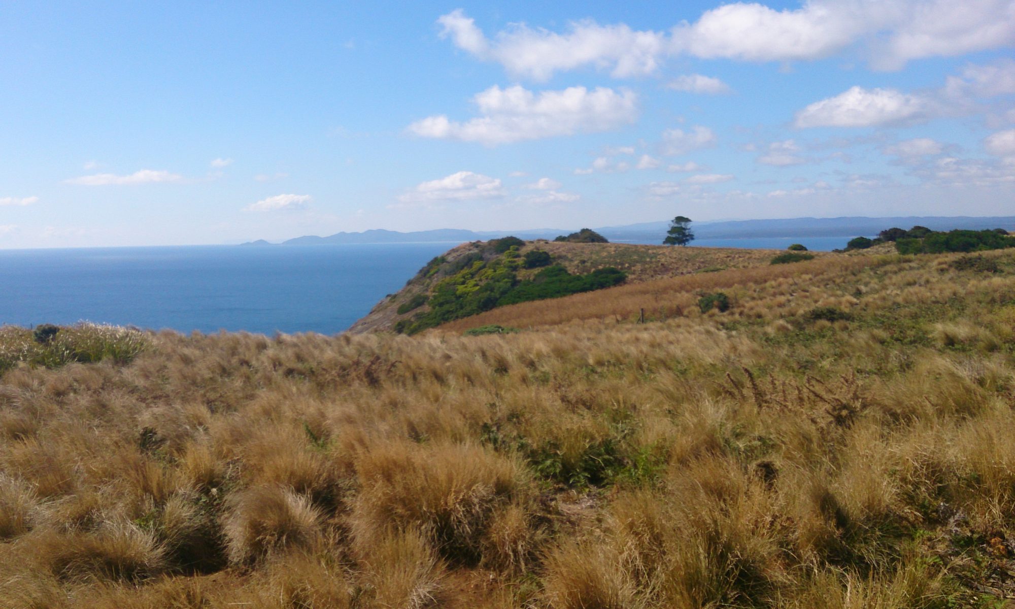
Just a hop, skip and a jump from mainland Tasmania lies Goat Island. This two-peaked wonderland can be walked to at low tide across a rocky shelf. It is a geologist’s, photographer’s and inner-child’s paradise! You can see east to Ulverstone or west to the Three Sisters as well as discovering wonderful views beneath your feet. I ran around on the rock shelf like a happy kid (no pun intended!) for quite some time before reaching Goat Island proper.

On the island
On the island © emily@traversingtasmania 2017

While I’m not sure where the island got its name, Mr. Traversing Tasmania is a bit of a mountain goat, so he demonstrated one possibility by scampering up the steep, rocky slopes. I stayed down a little lower on “safer” ground but somehow managed to slip anyway! Small tracks will lead you around Goat Island, to the peaks, a cove and a very special cave.

Bass Strait
Bass Strait © emily@traversingtasmania 2017

I’ll get to the cave. First, you must explore the rocky cove with wonderful views of Bass Strait. I found two fascinating rock pools, perhaps the best I’ve ever seen, on top of a rocky ledge. The patterns and textures of Goat Island are incredible. Jagged edges, fiery lichen, unusual seaweed, muscles… the island has it all. To the rear of the cove is a stand of trees covered in vines. It’s a surreal place.

Cave
Cave © emily@traversingtasmania 2017

Walking east around the rocks from the cove, you’ll find the cave. This cave is very unusual because you can crawl through it, there’s a rock pool inside it and it is heart-shaped. Before you get all swoony, the very non-romantic feature of the cave is its fly population. They are in plague proportions. Yuck! Mr. Traversing Tasmania crawled through the cave anyway. Be aware that you will need to climb down the heart-shaped side – don’t rush away from the flies too fast!

Lichen
Lichen © emily@traversingtasmania 2017

The tide will come in, as it always does. You can find updates about the tides here (note that the page shows information for nearby Picnic Point Beach). You want to visit Goad Island when the tide is at a low point (or shortly before this). Do not lose track of time on the island. This is dangerously easy to do but will see you stranded there. While I have no doubt that this would be an adventure in and of itself (and would make for great photos), you’ll miss out on the many other beautiful sights in nearby Ulverstone and Penguin.

What to Bring

Two Peaks
Peaks © emily@traversingtasmania 2017

You’ll need sturdy shoes. The rocks are sharp and you won’t make it over the rock shelf to the island (or around the island to the cave) without them. I always take a back-pack with first aid necessities and I take weather-appropriate gear too. Leave your bathers in the car because this island is for exploring, not relaxing or swimming! Make sure that you bring your camera every part of the island is ridiculously photogenic.

Getting There

Three Sisters
Three Sisters © emily@traversingtasmania 2017

You’ll find Goat Island on Penguin Road, which is the old highway between Ulverstone and Penguin along the coast. Follow Queen Street out of Ulverstone, driving for about five minutes, or Main Road out of Penguin, driving for about ten minutes. Look for signs to Goat Island. There is a small car park across the railway lines but take care as trains do use the railway. Your visit will be restricted by the tide but, if you time it right, you’ll have a lovely experience.

Cost

Cave
Cave © emily@traversingtasmania 2017

Tasmania really is a fabulous place and much of it can be explored for free. Goat Island is no exception. Perhaps you could respect this privilege by taking any litter you find with you. Have a grand adventure on a very unusual island!

Staying in the area for a while? There’s more to see in Tasmania’s north west, north and west coast.
Turners Beach

Traversing Turners Beach
Treasure Hunting
Treasure Hunting © emily@traversingtasmania 2017

This week, we stayed at Turners Beach. The beach faces onto Bass Strait and is strewn with large pebbles, sun-bleached driftwood, seaweed, sponges, cuttlefish and other fascinating offerings from the ocean-floor. At low tide, the sand is revealed, along with more gorgeous pebbles, shells and sponges. Turners beach is a treasure-hunter’s paradise.

High Tide
High Tide © emily@traversingtasmania 2017

At high tide, the only way of moving along the western end of the beach is to walk on the pebbles, which is an adventure. You never know what you’ll find among the driftwood. Unbelievably, there were surfers in the water, taking advantage of the high-tide waves. The sound of the waves dragging back across the rocks is very unusual! It was a fantastic sound to fall asleep to.

Low Tide
Low Tide © emily@traversingtasmania 2017

At low tide, you can walk the length of the beach on the sand. You can also see why there are so many warnings signposted on the public access points to the beach. Sandbars and previously hidden piles of pebbles create brilliant waves but, combined with strong currents, make for less than ideal swimming conditions. Have a lovely paddle and explore the debris instead.

Public Walkway
Public Walkway © emily@traversingtasmania 2017

Public access to Turners Beach is via the esplanade. The most prominent access is via a wooden walkway opposite the popular La Mar Café Providore. This entry has some carparking and two picnic shelters. There is also a viewing platform which is a great spot for taking photos and enjoying the atmosphere of the beach at high tide. When you reach the sand, walk to the right and you’ll find the River Forth. To the left, you’ll find the unusual pebbles and oceanic paraphernalia that make Turners Beach so distinctive.

Getting There

Turners Beach
Turners Beach © emily@traversingtasmania 2017

Turners Beach is approximately 15 minutes’ drive from Devonport along the Bass Highway. Coming from the west, it’s a 5-minute drive from Ulverstone. Drive along the esplanade until you reach the end. Parking is available near the public entry to the beach.

Cost

Turners Beach
Turners Beach © emily@traversingtasmania 2017

There is no cost to visit public beaches in Tasmania. I encourage you to pay for your visit in kind though, by taking three for the sea. I also highly recommend visiting La Mar Café Providore. They have a great menu, lots of options for those with food allergies, a lovely atmosphere and a wonderful variety of food and home-ware items to browse. It’s winter now and sitting beside their wood fire was an absolute treat!

Read more about my adventures in Tasmania’s north west here.

Leven Canyon

Traversing Leven Canyon
Leven Canyon
Leven Canyon © emily@traversingtasmania 2017

Today, it snowed at Leven Canyon in Tasmania’s north west. I know this because I was there. By there, I mean at Cruikshanks Lookout, high above the thundering rapids, being blasted with snow. It was awesome!


Picnic Area
Picnic Area © emily@traversingtasmania 2017

We arrived to a scene from a fairy-tale. Trees towered above us. Ferns surrounded the picnic area. The ground was covered in snow. If we had wanted to, we could have made a fire in the barbeque hut and cooked lunch but I’m glad that we continued to the lookout instead. It was perfect timing.

Track
Track © emily@traversingtasmania 2017

Access to the lookouts is via the Fern Walk (from the lower picnic area) or via the path to Cruikshanks Lookout. The walk can be done as a circuit. I recommend visiting Cruikshanks Lookout first as you can then descend the almost-600 steps to the track below instead of ascending them.

Cruikshanks Lookout
Cruikshanks Lookout © emily@traversingtasmania 2017

When we reached Cruikshanks Lookout, it had just started snowing. The lookout juts out from the hill and is very exposed. Hold on to your hat! The Leven River roared below us and limestone cliffs stood around us at a commanding 300 metres. The wind whipped snow into our faces. It was an incredible sight: Leven Canyon seen through a veil of snow.

Forest Steps
Forest Steps © emily@traversingtasmania 2017

Descend the (many!) Forest Steps to the Edge Lookout below for another spectacular view. This time, you’re much closer to the rapids but still at quite a height above them. As always with Tasmania, the weather can change at any moment. When we stepped out onto the Edge Lookout, we were greeted with the warmth of the sun (and a small pocket of phone reception!).

Leven River
Leven River © emily@traversingtasmania 2017

From the Edge Lookout, it’s an easy walk back to the carpark. Well, almost! There might not be any steps but the uphill trudge was hard-going! The track is well-maintained. There are benches at regular intervals along the circuit’s tracks. These are essentially horizontal signposts, showing you how far you are from the nearest location (car park, bridge, lookout) in either direction and are a great motivation to keep going!

Getting There

Roadside View
Roadside View © emily@traversingtasmania 2017

The Leven Canyon Lookout is approximately 45 minutes’ drive from Ulverstone via the B15 or the B17 (the latter goes past the turnoff to Wings Wildlife Park). The drive there was very picturesque, with snow beside the road and on the distant mountain tops. As always with Tasmania’s country roads, take care on corners, particularly on icy days like today. When you arrive at Leven Canyon, there is ample car parking. Watch out for our native animals.

Cost

Leven Canyon
Leven Canyon © emily@traversingtasmania 2017

There are no entry fees at Leven Canyon. Toilet and wood-fired barbeque facilities are available for public use. Do not light the barbeques during a total fire ban! There are also plenty of picnic tables for public use. It’s a great spot to visit.

You can read more about my adventures in Tasmania’s beautiful north west here.