Lake St Clair

Traversing Lake St Clair
Lake St Clair
Lake St Clair © emily@traversingtasmania 2018

Lake St Clair is beautiful. Snow-capped mountains to behold, crisp air to breathe, still waters to stand beside and gorgeous forests to explore. We did a network of short walks (larmairremener tabelti, Watersmeet and Platypus Bay) that form a fairly level 4.7km looped track.

larmairremener tabelti
larmairremener tabelti © emily@traversingtasmania 2018

No matter what your ability, you should be able to do at least the first part of the walk. You can choose to reach Watersmeet either via the main track or via the larmairremener tabelti track. The main track is wide and flat but the larmairremener tabelti track showcases the area’s unique fauna. You’ll also find interpretive panels and artworks that commemorate the Tasmanian Aboriginal people of the area. The second route also takes you alongside a stretch of the river, which is very peaceful.

Watersmeet
Watersmeet © emily@traversingtasmania 2018

All roads lead to the churning roar of Watersmeet. I wasn’t expecting the sights and sounds that awaited us. Two rivers meet to form one. I could have stood on the bridge and watched the seething waters for quite some time but Mr. Traversing Tasmania was keen to get going!

Barge wreck
Barge wreck © emily@traversingtasmania 2018

Platypus Bay was our next stop. You’ll have views of the lake and, if you’re lucky, of a platypus too! The best times to spot a platypus are early in the morning or in the evening – the closer to dawn and dusk the better. There are hides on the track that will allow you to see the platypus without being spotted by them, as long as you are quiet. Keep walking onwards and you’ll find a lakeside beach and a wrecked barge. This provides a lovely opportunity for photos of Lake St Clair.

What to Bring

Views to ferry and Pumphouse Point
Views to ferry and Pumphouse Point © emily@traversingtasmania 2018

If you’re planning on platypus spotting, particularly in the late afternoon, remember that you may need a torch. Bring a head torch rather than relying on your phone as, if you’re anything like me, your phone is probably renowned for being close to flat at just the time you need it to be fully charged! Even though you are only travelling a short distance on relatively easy terrain, no one should set out on a bush walk without food, water, basic first aid supplies, sturdy shoes, clothing that suits the season and a map. You’ll need waterproofs on rainy days, warm clothes in winter and sun protection in summer. Grab your map and register your walk at the Visitor’s Centre, which is also the start of the walk.

Beach near campsite
Beach near campsite © emily@traversingtasmania 2018

In the Visitor’s Centre, you’ll also find a gift shop with some supplies for bush walking and an interpretive display of information about the area. It’s a welcoming space. There is also an amenities area and a cafe next to the Visitor’s Centre. If you’re planning on camping at the lovely site by the lake’s edge, you’ll be pleased to know that the amenities area has a drinking water tap and a sink for washing dishes.

Getting There

Hut
Hut © emily@traversingtasmania 2018

Lake St Clair is a two-and-a-half-hour drive from both Launceston and Hobart. Allow at least three hours to complete the drive as the roads can be hazardous depending on the weather and time of day. If possible, arrive before dusk to avoid unwanted encounters with the many wild animals that live in the central highlands. If you have to drive after sundown, take it very slowly and carefully, for the sake of your vehicle as well as the native wildlife. Follow signs for Lake St Clair and you’ll find the Visitor’s Centre is at the end of Lake St Clair Road (C193).

Cost

Bridge to Shadow Lake track
Bridge to Shadow Lake track © emily@traversingtasmania 2018

You’ll need a Parks Pass to enter Lake St Clair National Park. These are available for purchase at the Visitor’s Centre and online. Tourists should purchase a one-day pass for $12 per individual or $24 per vehicle. If you’re a local or you plan to visit multiple National Parks during your Tasmanian holiday, the Parks and Wildlife Tasmania website shows you more options. Parks and Wildlife do a wonderful job of preserving, managing and providing interpretative information for our National Parks so you can rest assured that your money is being well spent! Enjoy your walk in the stunning Lake St Clair National Park.

From Lake St Clair, you can visit more of Tasmania’s central highlands. Alternatively, head west, south, north or down to the midlands. Looking for somewhere to stay? Read my article on nearby Pumphouse Point.
Macquarie Heads

Traversing Macquarie Heads
Macquarie Heads
Macquarie Heads © emily@traversingtasmania 2018

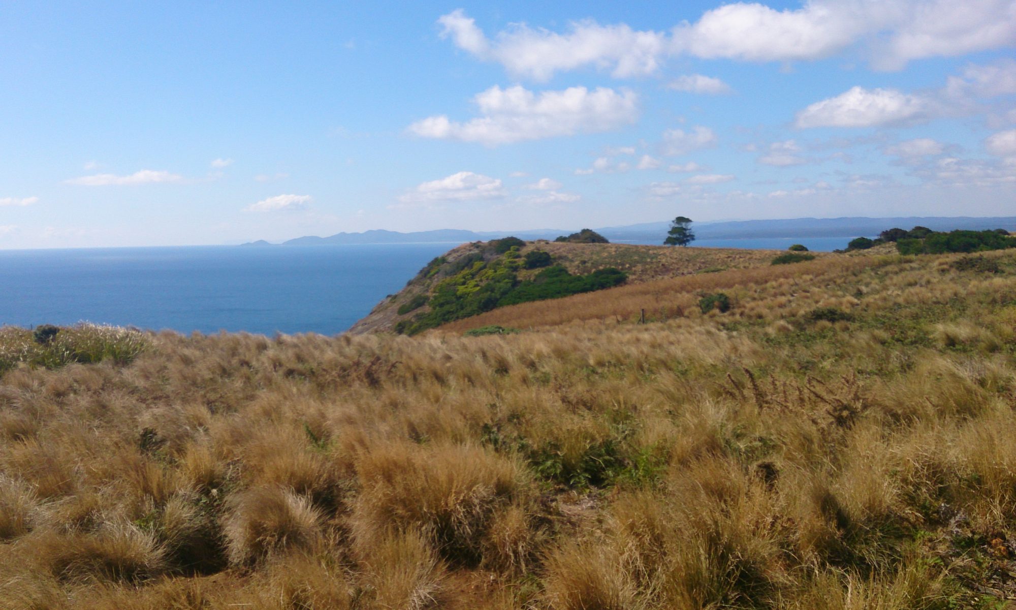
Macquarie Heads are the headlands that meet at Hell’s gates, the narrow, shallow entrance of Macquarie Harbour. There are loud quad bikes, dirt-bikes and 4WDs everywhere, combined with a crisscross of kids and fishing rods. If you’ve seen the classic Australian film The Castle, you’ll be saying, “Ah, the serenity!” with a smile on your face. Noisy neighbours aren’t your only problem either. As we were walking back from the beach, a tiger snake (that’s a bad one, folks!) silently slithered away from the path. So… don’t go to Macquarie Heads? Well, actually, it was fantastic.

Macquarie Harbour
Macquarie Harbour © emily@traversingtasmania 2018

Strangely for the west coast, which has an average of 2.4 metres of rain each year, it was a fabulously sunny day. Many took the opportunity to go fishing. A few keen people went for a swim. I was content to paddle and gaze at the view of the harbour, ringed by mountains, and the lighthouses.

Lighthouse
Lighthouse © emily@traversingtasmania 2018

There are two gorgeous white lighthouses at Macquarie Heads. These have helped sailors to navigate the narrow, shallow passage into the harbour for many years. You’ll also see three fisherman’s cottages (inaccessible by road but apparently available as holiday rentals, accessed via boat). If you know where to look, you can just make out the two rock walls that were created by convicts in the 1800s in an effort to keep the channel deep enough and safe enough to sail through. It’s a photographer’s delight!

What to Bring

Lighthouse
Lighthouse © emily@traversingtasmania 2018

It’s the west coast so you’ll need your sunscreen, sunhat, beanie, scarf, gloves and your wet-weather gear. If you’re planning on staying for a few hours or longer, I’d recommend bringing your rod and tackle and trying your hand at catching lunch. You’ll also need to bring your own food, water and firewood (if fires are permitted at the time of year that you visit).

Getting There

Ocean Beach "Road"
Ocean Beach “Road” © emily@traversingtasmania 2018

Macquarie Heads is about a twenty-minute drive from Strahan on Macquarie Heads Road. You’ll see clear signs from Strahan. The road is partly sealed, partly dirt and is very picturesque with more views of Macquarie Harbour as well as pine forests. Once you reach the campsite, keep driving until you reach the final car park. You can also drive your 4WD onto the beach if the conditions are right (see my post on Ocean Beach for more on beach driving). Ask locals to show you the best entry to the beach (one is extremely sandy and best avoided).

Cost

Hell's Gates
Hell’s Gates © emily@traversingtasmania 2018

Macquarie Heads is free to visit for the day. You’ll find the best smelling bench-seat dunny (toilet) and glorious views. To camp, you’ll pay a small fee but have the benefits of grassed sites, a caretaker, a boat ramp and those views. Next time you’re in Strahan, take the time to see a very historic, very picturesque part of Macquarie Harbour.

Read more about my adventures on Tasmania’s wild west coast.

Corinna

Traversing Corinna
Corinna
Corinna © emily@traversingtasmania 2017

Who wouldn’t want to stay the night in a ghost town? How about one on the edge of the takayna/Tarkine? What if you could then spend the day traversing ancient rivers, forests and mountains and the evening snuggled up next to a gas heater in a pioneer-style hut? Welcome to Corinna, an ex-mining town on the north bank of the Pieman River on Tasmania’s wild West Coast.

Tarkine Hotel
Tarkine Hotel © emily@traversingtasmania 2017

Corinna is the Tasmanian Aboriginal name for the Pieman River. The town was established during the gold rush of the late 1800s. Here, 2500 people lived and a 7.5kg gold nugget was discovered. This is still the largest gold nugget found in Tasmania. The town had a substantial two-storey pub, which was later dismantled and moved to the south side of the river before being moved to Zeehan and, unfortunately, burnt down. The area was also logged and the wood taken back to England for use as banisters, masts, and so on. Prior to this, the Tarkiner people (hence the name Tarkine) lived here. There are still giant middens on the coast: remnants of their lives and sacred sites.

Pademelon
Pademelon © emily@traversingtasmania 2017

All of the huts at Corinna (some original and some recently constructed) bear the name of a person associated with the town’s history. We stayed in Louise Lovely, named after the lady who produced and starred in the film Jewelled Nights shot partially on Tasmania’s West Coast. The town now has no permanent residents, except for a Tasmanian Devil (in the car park) and a large number of friendly pademelons.

Short Walks
Short Walks © emily@traversingtasmania 2017

There are plenty of things to do at Corinna. You could easily spend three full days here. I recommend planning your trip around a cruise on the Arcadia II (a longer cruise to the Pieman Heads, which you can read about here) and the Sweetwater (an hour-long cruise to the wreck of the Croydon and to Lovers Falls, which you can read about here). You could do this during a day if you can manage to book a spot on both cruises. Your other two days could be spent walking, or even kayaking. It is possible to walk from Corinna to the summit of Mount Donaldson (yes, we did that too!) or you can take a series of shorter walks around Corinna. Kayaks are available for hire from the Tarkine Hotel.

What to Bring

Kayaks at the Savage River
Kayaks at the Savage River © emily@traversingtasmania 2017

There is untreated rainwater available at Corinna. You will also find complimentary bottled water in your fridge. I wish that I had brought my 20L drum of water with me though as the rain water tastes quite thick (that’s my best description!), even after you’ve boiled it for the required three minutes to treat it. I also wish that I had brought some insect repellent and eucalyptus spray (my preferred insect spray) as we were kept awake by mosquitoes on the second night. Even writing this is making me feel itchy!!

Replica Huts
Replica Huts © emily@traversingtasmania 2017

You should also bring food. The Tarkine Hotel serves lunch and dinner (not in winter) but you do pay middle-of-nowhere prices. They can cater for dietary requirements if you book in advance. There are a few (mainly tinned) food supplies available at the “General Store” part of the Tarkine Hotel. However, you will need to provide breakfast and snacks for yourself. I’d also recommend bringing some food for bushwalking. We cooked a meal – a pasta dish – on the four-burner cook-top in our hut and enjoyed staying in to a homely meal. There are ample pans and utensils provided.

Last of all, bring warmth and a good book. You’ll have no mobile reception, so snuggle up in your slippers and travel rug and read. There are some coffee-table books on the takayna/Tarkine and Tasmania supplied. When you’re outdoors, having good shoes, waterproof clothing and appropriate layers is a must. Remember sun protection in summer and don’t forget your camera. The wilderness is breathtaking!

Getting There

Fatman Barge
Fatman Barge © emily@traversingtasmania 2017

You can reach Corinna from several directions. Drive south from the North-West tip of Tasmania, following the unsealed Western Explorer. Alternatively, travel north from Zeehan, crossing the Pieman River via the Fatman Barge ($25 per voyage). This is an excellent way to travel as the barge is cable-driven, the only one of its kind in Tasmanian. Take note of operating hours though: 9am – 5pm during non-daylight savings hours, with hours extended to 7pm during summer.  Lastly, you could drive south from Burnie, via Waratah. This is a sealed road until you reach Savage River. From here, it’s 21kms of unsealed roads until you reach Corinna. Make sure that you fill up with petrol before you make the journey as there is no fuel available in Corinna.

Cost

Accommodation
Accommodation © emily@traversingtasmania 2017

Accommodation in one of the recently constructed pioneer-style huts costs $220 per couple per night night. There are bigger huts available and also cheaper options: groups can stay in the original pub and couples can stay in the original Roadman’s Cottage. If you’re really pinching pennies (and it’s not too cold or wet), you can even camp at Corinna. Whatever option you choose, make sure that you book in advance. I happily paid for the luxury of having all the mod cons (an ensuite, lighting, a four-burner gas cook top and a lovely log-style gas heater) in the middle of nowhere. Corinna runs on solar power and a satellite phone link so enjoy your time in blissful isolation!

You can read more about my time in Corinna here. You can also read about my adventures on Tasmania’s West Coast here or North West here.

The Neck Game Reserve Camp Ground

Traversing Neck Beach

This week, we camped with a friend on Bruny Island at The Neck Game Reserve Camp Ground. We had three days of unseasonably warm weather. The sky was gorgeous, bird-life was plentiful and the sound of the waves crashing against the shore lulled us to sleep.

Sunrise
Sunrise © emily@traversingtasmania 2017

There’s something wonderful about waking up to bird-calls and sunlight shining through trees. There’s something even more wonderful about strolling down to the beach, watching the sun rise higher and joining the short-tailed shearwaters paddling in the shallows. The Neck Game Reserve Camp Ground is right next to Neck Beach, with just the dunes separating the two areas. It is a spectacular piece of coastline.

View from The Neck Lookout to Cape Queen Elizabeth
View from The Neck Lookout to Cape Queen Elizabeth © emily@traversingtasmania 2017

We arrived at the camp ground at about 2pm. After we had set up camp, we walked back to The Neck Lookout. We dawdled, taking photographs, admiring the birds, and even stopping for a rest, and it took us about an hour and a half to get there. The Neck Lookout is unique as it is a rookery for both mutton birds (short-tailed shearwaters) and penguins. We could hear the penguins but it became too dark to see them (and we had a long walk back to the campsite). Next time, I’ll take a red-light torch (or even just a piece of red cellophane to put over a standard torch) so that I can see them at night! Make sure that you take care of the penguins by staying on the paths, taking all rubbish with you and not shining bright lights (including camera flashes) in their eyes.

Facilities

The Neck Game Reserve Camp Ground
The Neck Game Reserve Camp Ground © emily@traversingtasmania 2017

The Neck Game Reserve Camp Ground has about thirty unpowered sites. When we were there, we shared the camp ground with caravans, campervans, 4WDs with pods on top, and even a cyclist with a tiny tent who was cycling the 60kms to Hobart the next day. It was a nice atmosphere and everyone was very respectful (toilet lid down, quiet at night, sleep-in in the morning… marvellous!).

Day Use Area
Day Use Area © emily@traversingtasmania 2017

Two pit toilets are available for use in two different locations. This means that the toilets are within easy reach of most sites. When we arrived, there was no running water but water was available the next day. To drink this untreated water, you’ll need to boil it for three minutes at a rolling boil. We brought our own drinking water and just used the water there for washing up. There are two picnic tables and a fireplace for day use. Camp fires are allowed at your site too, although you’ll need to bring your own firewood. I recommend also bringing your own fold up chairs, table and cooker to make cooking and eating at your site that bit more enjoyable.

Getting There

View of Neck Beach
View of Neck Beach © emily@traversingtasmania 2017

For instructions on getting to Bruny Island, read my post about the island here. Once you’re on Bruny, head south towards The Neck. Follow signs from the ferry for Alonnah and Adventure Bay. Once you’ve passed The Neck Lookout, you’re close! A few kilometres down the road, you’ll see blue signs to The Neck Game Reserve Camp Ground on the left.

Cost

Paddling with Birds
Paddling with Birds © emily@traversingtasmania 2017

Camping at The Neck Game Reserve Camp Ground costs $10 per site (for two adults) and $5 for each extra adult. We paid $30 for two nights which is an absolute bargain considering the scenery! For up to date prices, see Parks and Wildlife’s information here. Sites are not able to be booked in advance and you will need cash (and a pen) in order to pay the fees via the self-registration box at the camp ground.

To read more of my posts about Bruny Island, click here. For posts about southern Tasmania, click here.